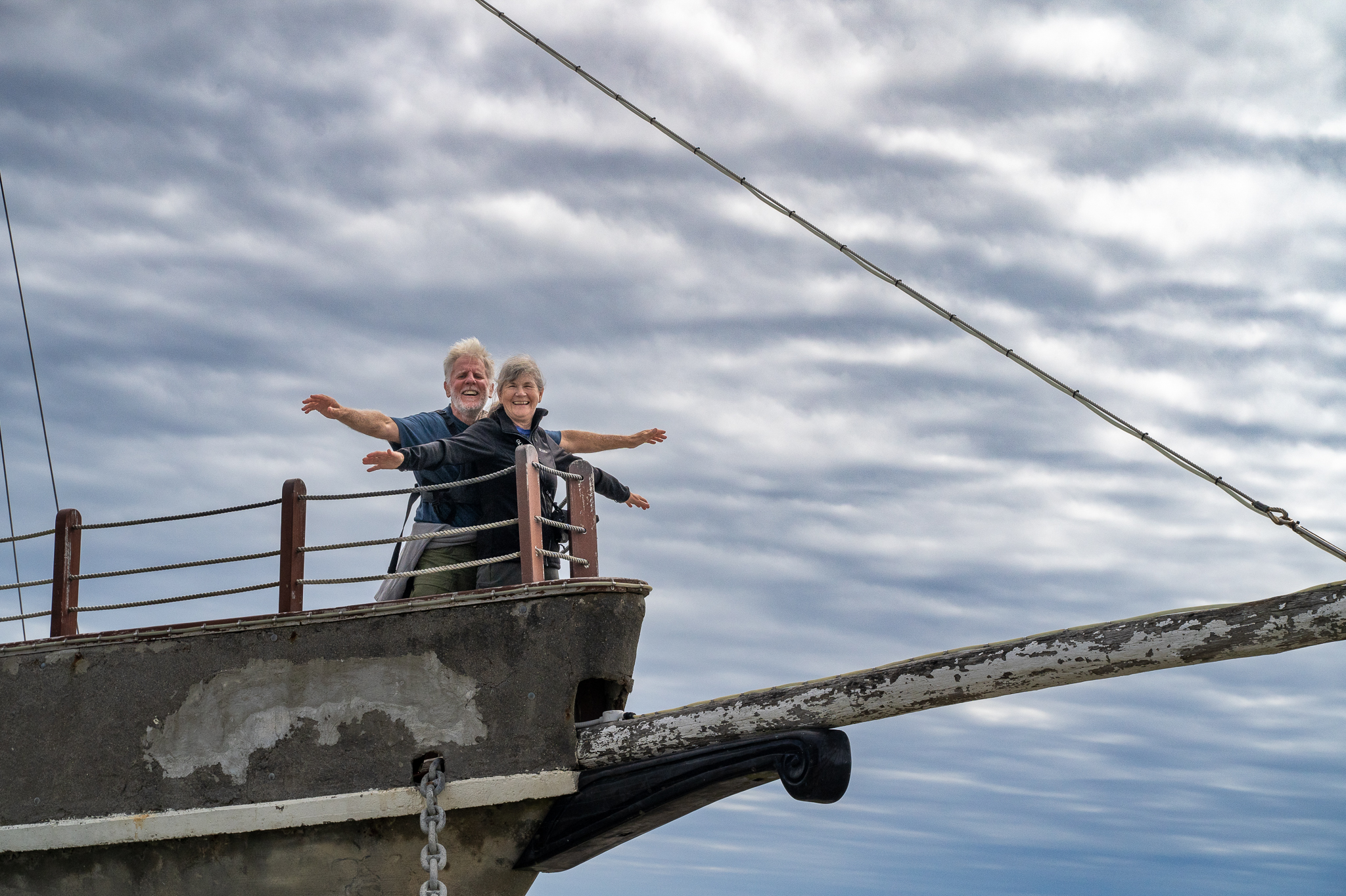
Nice drive from Te Anau to Bluff which is just south of the major town of Invercargill to catch the ferry. We were there early as usual and so a quick cuppa and a giant scone at the local cafe and a walk around the town passed the time till we caught the ferry. The ferry takes an hour and goes across the Foveaux Strait. It was far from a calm crossing but it was all good.
Checked into our lodge, which was part of the grounds for the local hotel. The town is called Oban and is pretty much the only part of the island that is occupied as at least 80% of the Island is the Rakiura reserve and there is a hut to hut walk that takes 3-4 days but I think we have done our share of those. Dinner in the hotel was good, it was also the local pub for the residents so there was a good atmosphere and a lot of interesting characters.
Next morning we caught the water taxi to Ulva – only a 10 minute journey but once out of the bay…….. very bouncy. Ulva is not lived on and is a sanctuary for the local bird life. We were there by 9 so a bit late really for any substantial sightings but the guide was able to point out some of them, one of which was a Robin only found on Ulva and Stewart Island. We walked through some really old forestry and onto a few little bays and altogether it was a pleasant way to spend the morning. Stopped for some local fish and chips for lunch and then had a relaxing afternoon. Dinner was at a food truck called Fin and Feather and it was amazing. Rob had Elk and I had mushroom, you could have them as a burger or in a salad and the salad was all sorts of yummy flavors. It was followed by a pannacotta that had popcorn, cardamom and other things added which was also very delicious.
Next day we took a water taxi to Port William and hiked back to Oban, the walk went up and down the various headlands and across the little bays and it really was beautiful scenery. Being the overachievers (idiots) that we are there is a decision point at the 9 mile mark, you can either walk a mile back into town or add on the last headland and you can all guess what we chose. Not realizing that this added another 4 miles and made the ups and downs of the previous trail look flat by comparison. Still we were happy to complete it and felt that we earned our pizza in the hotel bar that evening. As it was a Friday, some of the local were singing sea shanties in the bar so it was a good time to be there..
Saturday morning arrived and we were very grateful that we had changed our Ferry to the 8am and not the noon one, we had done it to make sure we were in Waihola early enough for the BBQ that was being cooked as Jim, Toni’s dad, was 82 and we were having a celebration for him. The reason we were so grateful was that the crossing was the bumpiest so far and the weather forecast was for gale force winds to come in at 11am and I can’t even imagine what that crossing would have been like. Anyway, we arrived at Toni’s by early afternoon and enjoyed a warm welcome from Toni, Denise and Jim plus an amazing array of food that evening. We have decided that we probably need to stop eating when we get back to Georgia until the New Year!
So let’s start with a little of the how and why for these days, when we originally booked the flights to New Zealand, there were 2 things that were really important. Seeing our friend Toni and doing the Milford Track, everything thing we read and saw on YouTube talked about this being one of the best Great Walks in the world. I have to say, that’s only because they don’t all know Toni!
Our first thought was to do it the cheaper way which is backpacking all of your clothes food etc for the full 4 days and staying at the DOC huts along the track. But much to our good luck, the whole season was booked out within 7 minutes of it going up for sale this year, and there are very tight restrictions on the numbers of people allowed on the trail. The good luck part was, the fact that I think we woefully underestimated my ability to lug that much stuff over a mountain. Anyway there was a plan B, there is one private company that is allowed to take people on the walk and so a quick visit to the Ultimate Hikes website and I was able to secure the last double room available that fit in with our dates.
We have trained since August, building up the distance, number of consecutive days and carrying back packs and as you have all been reading, we continued that since we arrived in NZ, with some of the other notable walks here, Alpine Crossing, Roy’s Peak, Abel Tasman and many others. So with full packs (you still need to carry all your clothes and personal items for the 5 days) we were excited to meet the rest of our group at the Alpine Center in Te Anau.
After a short coach ride and some early introductions to the people that we were going to spend the most time with, we arrived at the end of Lake Te Anau for the boat crossing to the start of the track. A short trek to the Clinton Lodge for our first night where we were greeted with snacks and soft drinks. Our room was basic but clean and tidy with our own bathroom and shower. The power is only on between 6am and 10pm so an early night is your only option. We met our guides and had a team photo taken before going for a 90 minute nature walk, which I think was really intended to see how people handled very uneven rocky ground with lots of tree roots. The bar opened at 5pm (well I did say we were doing it the fancy way) and at 6.30 we sat down for dinner. Which was another really pleasant surprise, our dinner every night was a full 3 course meal with choices the day before on the main course and the standard was really high, it would have given most restaurants a run for their money. After dinner we had a briefing from the guides on what to expect the next day.
Breakfast was at 7 and you also made your own sandwiches for lunch from and extensive array of options and at 8.30 off we went. The standard format was a guide at the front, one around the middle and one at the end to act as sweeper. There were a few side walks as optional extras and those that know me, know that I am not one to hang around! We were up the front with just the lead guide in front of us and no one to be seen behind us, at some point Susan, the senior guide started to speed up and we thought, oh well, we better walk faster but after about 10 minutes, she said, very tactfully, could we wait and slow the rest of the group down as she need to get to the first hut to get the water on to boil for the tea to go with our lunch! We stopped for lunch and then set off to complete that days walk, we were warned that the last 3/4 of a mile was uphill and the last 1/4 was uphill and over boulders. It had just started to rain a little but so close to the next hut that we just kept going. The Senior guide was at the top of the boulder field watching as everyone hiked up and I asked her later that evening if that was to assess who would be able to make it over the pass and who was not really capable and she confirmed it. Luckily all of our group were allowed to continue. One additional feature of all on the lodges was they had a place to hand wash anything you needed and then there were 2 drying rooms, one at a cooler temperature to dry out boots backpacks and waterproofs and a really hot one to dry your clothes. It rained really heavily all night but was just misty and cloudy in the morning ready for the big one.
Although today was less miles, this was going to be the hike up and over the McKinnon Pass and so we had a 6am breakfast and a 7.30 am start for the hike. The climb up the pass was ok and in fact I found it easier than Roy’s peak over a distance of about 4.5 miles we ascended 500 mt the top was shrouded in cloud so no views from the top other than this Kea making sure we did not miss the warning sign.
We had an additional 1.5 miles to walk along the ridge before a stop at the lodge to eat our lunch. Our trip down the mountain was really REALLY hard it was only 3.5 miles but we had to hike the emergency route as the regular one was under avalanche warning and it dropped 900 mt over that distance, most of it boulders with water running through it. I think that’s the longest I have ever taken to cover such a short distance. But we made it and were amongst the second group down. Hot shower, get clothes sorted and relax with a glass or two of wine and another great dinner.
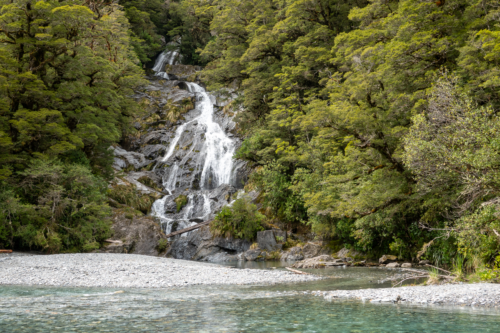
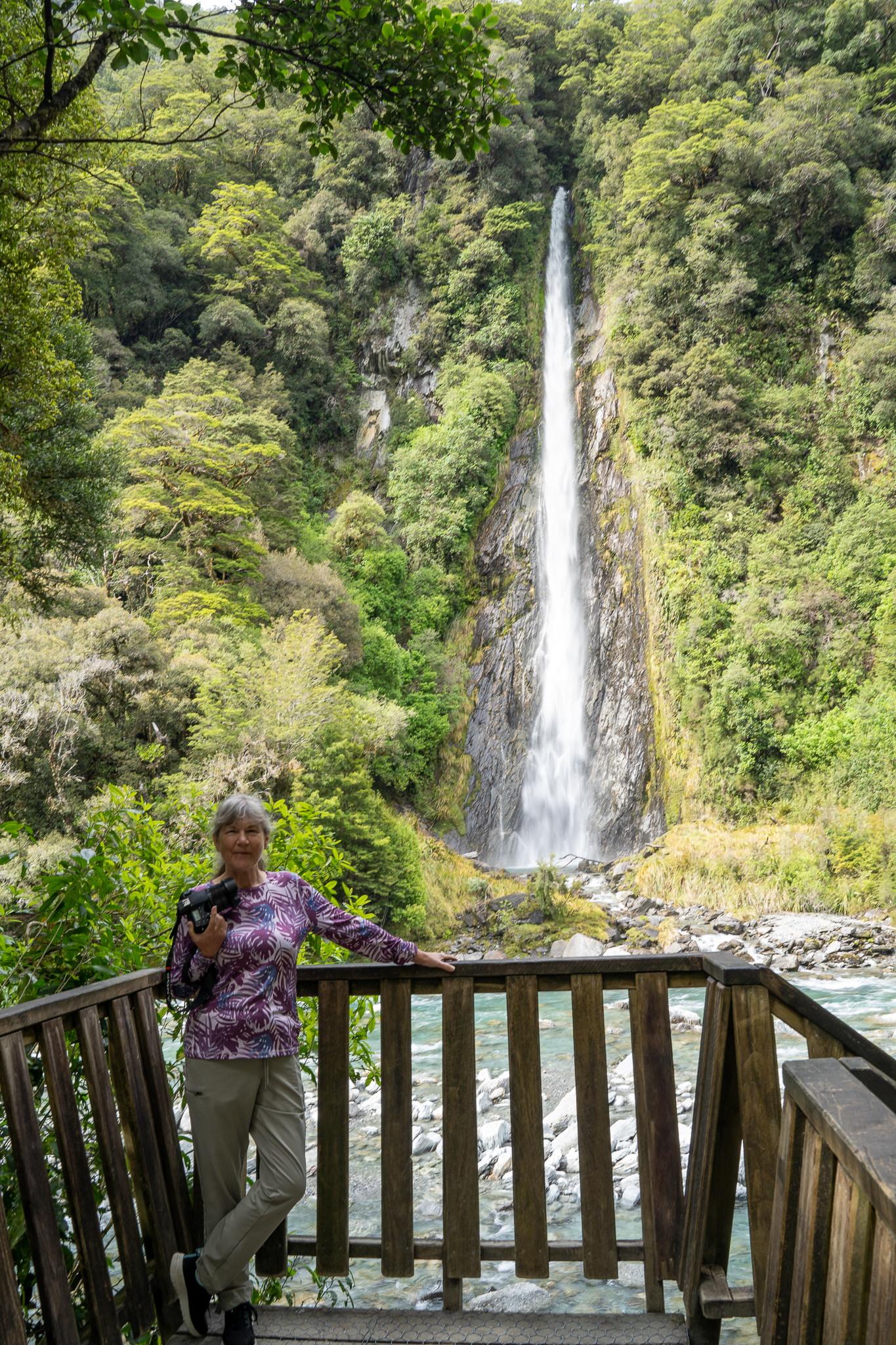
The final day of hiking was another early start and over 13.5 miles, the weather was perfect, crisp with no wind and not too much sun. We passed some spectacular waterfalls that had been enhanced by the overnight rains. There was a little scrambling over rocks and trees but it was generally an easy walk. Not that we (read me) are competitive but we were the first of the group to make the aptly named Sandfly point. So quickly got into the hut to wait for the water taxi over to the Mitre Lodge. We checked into the lodge and we had the most amazing view out of our window! And it had a bath!!!! Long soak to ease those muscles and down to meet our friends for a celebratory drink and dinner.
The weather was dry and sunny the next day ( a rare occurrence in the Sound) and part of the package with Ultimate is a trip up the Sound almost to the Tasmin sea. The views were great given that we had such a clear day. Back to the harbor and a coach ride over to Te Anau, even that was an interesting ride as the road is pretty narrow and it twists and turns up and over the mountain – including a trip through a pretty long tunnel that only had room for single direction traffic, controlled by traffic lights.
We were sad to say goodbye to our friends but there were many promises to keep in touch. we decided to just stretch our legs a little and walked over to the Te Anau bird sanctuary by the side of the lake. We were able to see some of the rarities that the Department of Conservation are keeping under a watch.
The trip from Cromwell to Te Anau was going to be about 3 hours and so we decided we would just stop wherever it made sense. The first place we came to was Arrowtown. This is what it says on their website “ Arrowtown is charming and quirky, a delightful gold rush village nestled beside the sparkling Arrow River and below magnificent peaks” we walked down the Main Street and took a few photos but really it is just a cute little shopping place, not something either of us are overly interested in. And so after about 20 minutes we continued our journey. One thing that was interesting was, the film crew that had blocked off the road to film for something in the local church, maybe we will see it in a future episode of Brokenwood. The scenery along the way was spectacular and made the travel worth while. We stopped at a roadside coffee van in a town called Garston and Rob had, what he described as an amazing lamb burger. My egg and cheese with all the veg was also excellent.
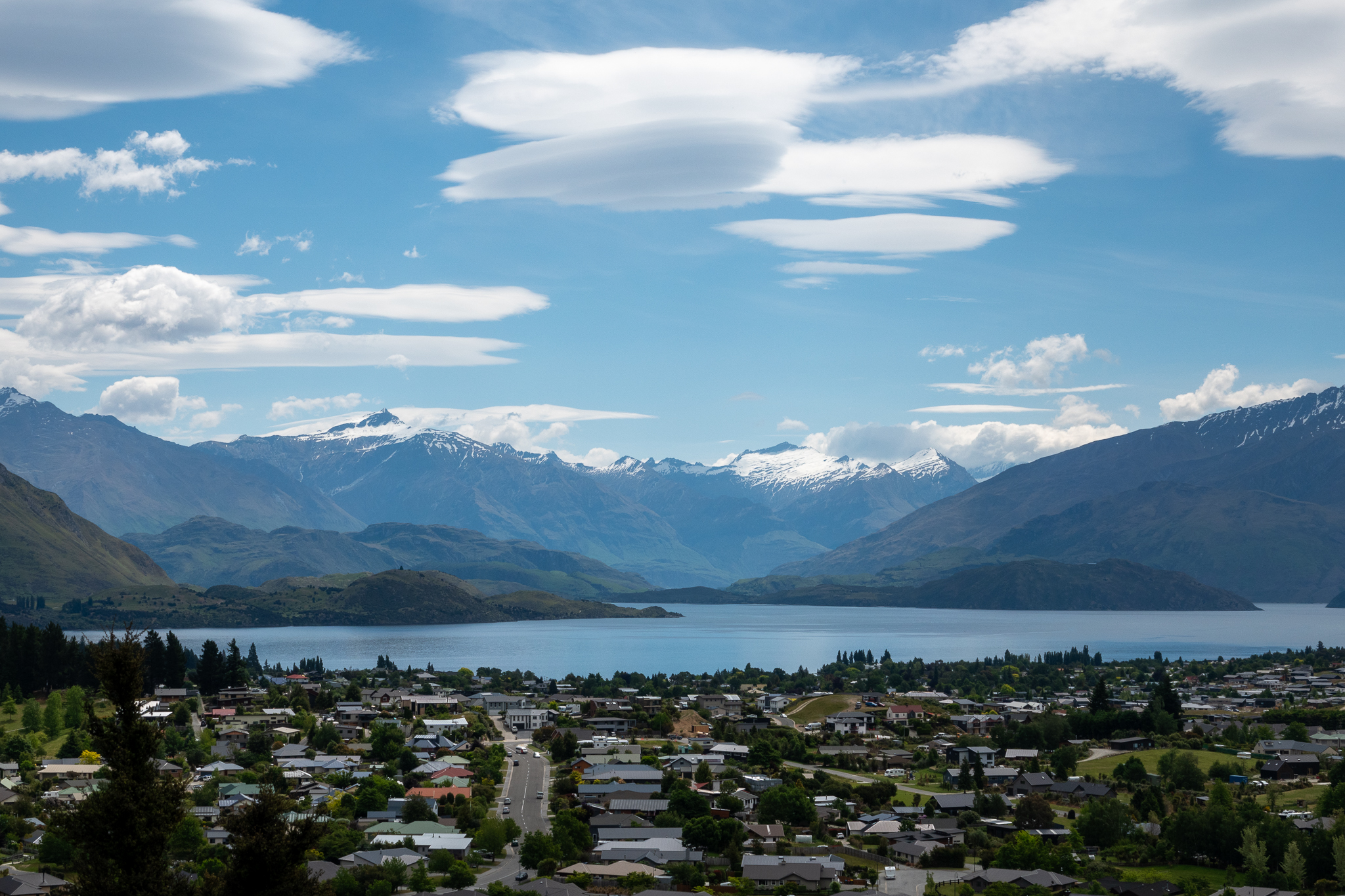
We arrived in Te Anau just after 2, checked into our hotel and then took a walk around the town to see what it had to offer. It is on the shores of Lake Te Anau and is the starting point for the Kepler track so was well served with both restaurants and sports shops. We had a great dinner at an Asian Fusion restaurant although I am sure we probably brought the average age up a few years.
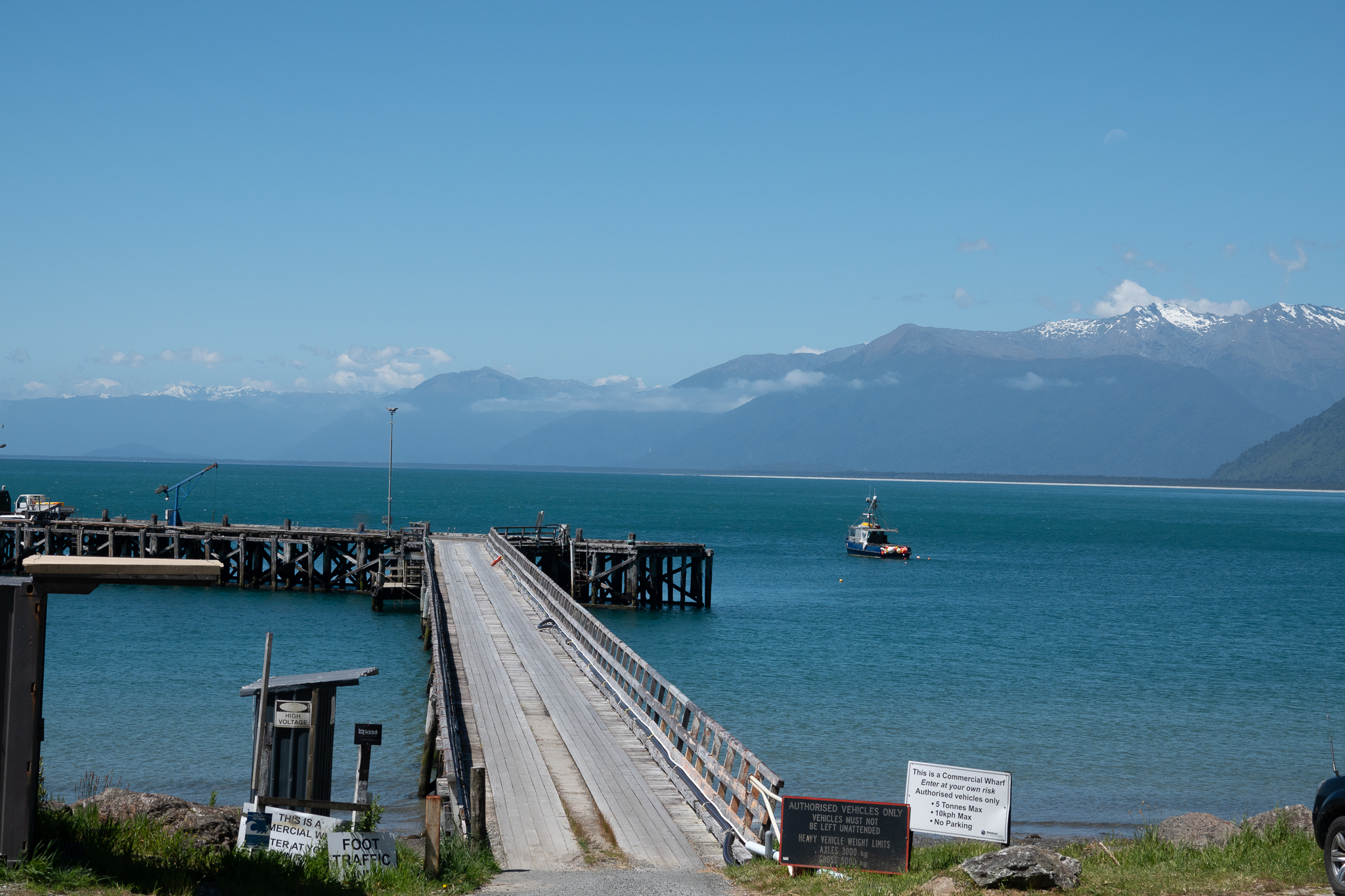
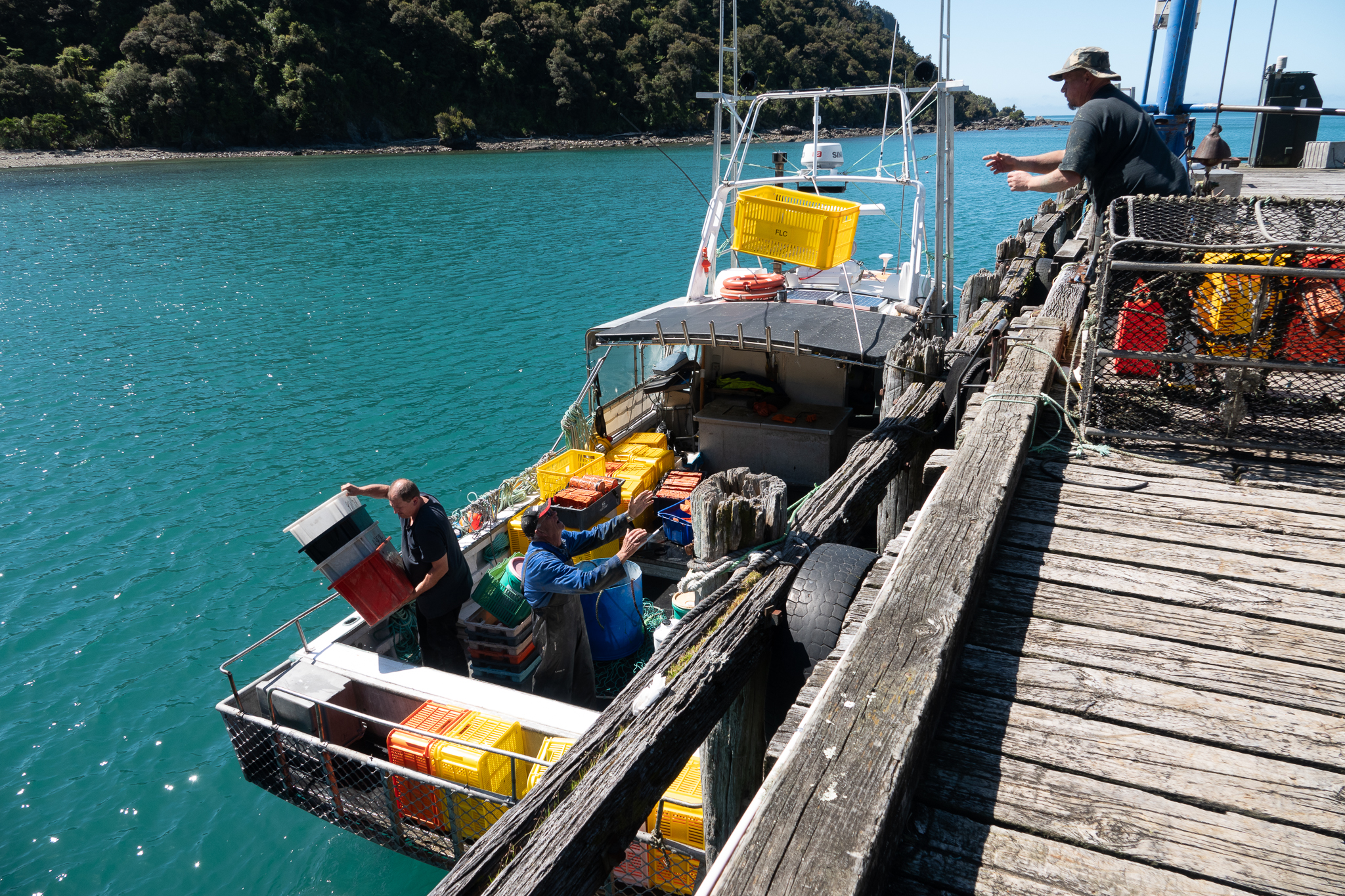
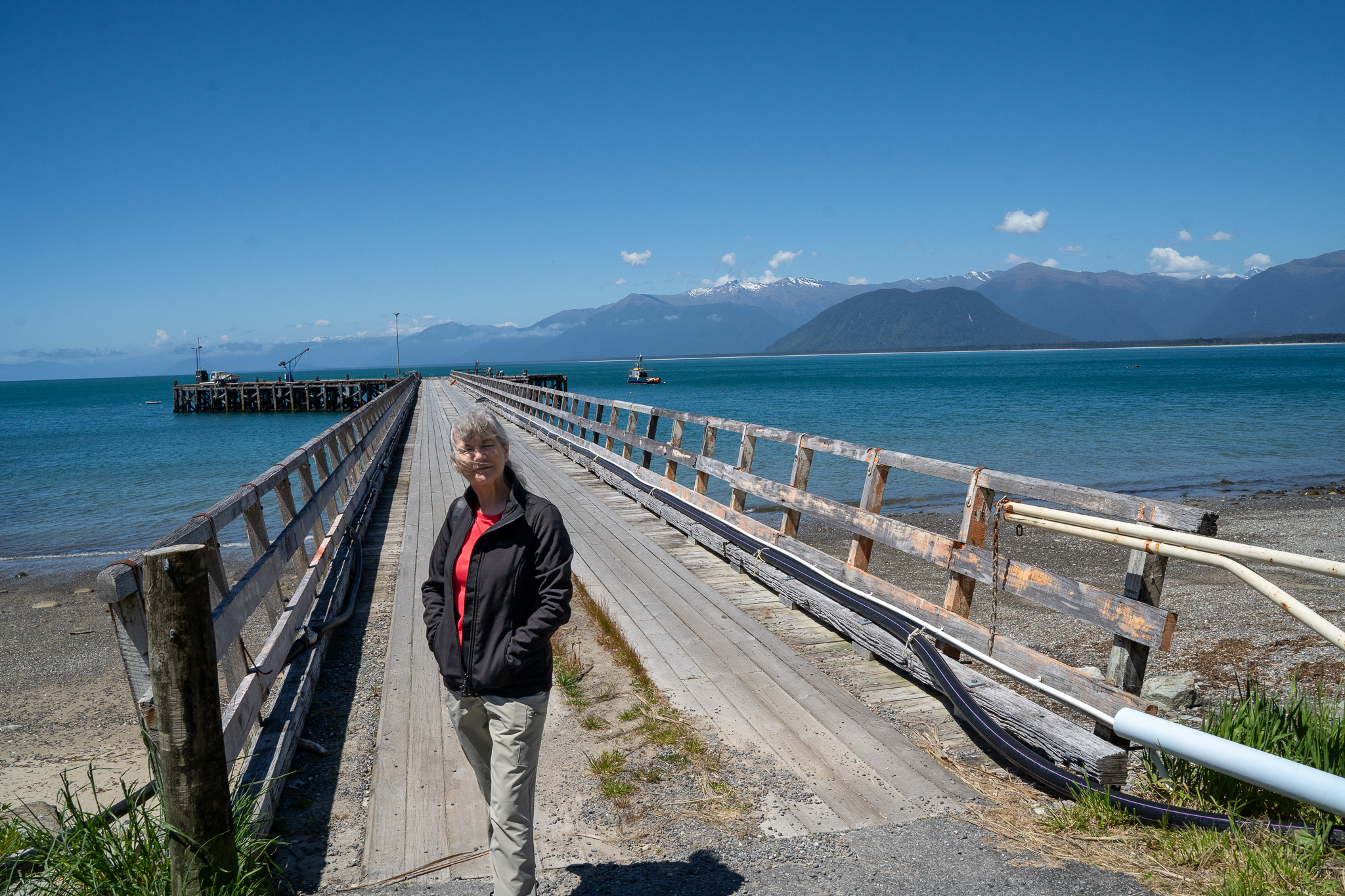
This morning we went to meet the tour company and go through our pre track briefing ahead of tomorrow. We then did a sample pack of our backpacks to make sure that we could fit everything in and also to check if we needed to buy anything. We were on our way into town to get some last minute bits and pieces, when we saw a seaplane coming into land. We looked at each other and then decided yes we would go and talk to them to see what was on offer. After a 5 min chat, we had booked ourselves onto, what they call, a one hour mystery flight for 2pm that day. It was such an experience, we flew up one of the Fiords, so close to the mountains it felt like we could touch them. We landed in a remote bay and the pilot pulled the plane onto the beach so we could get out a just walk around for a bit before continuing the flight back around to Lake Te Anau. As an indication of how quick the weather can change here, our landing at the bay was on smooth water and by the time we got back to the lake the wind was whipping up the water and the landing was a little bouncy. What and experience though!!
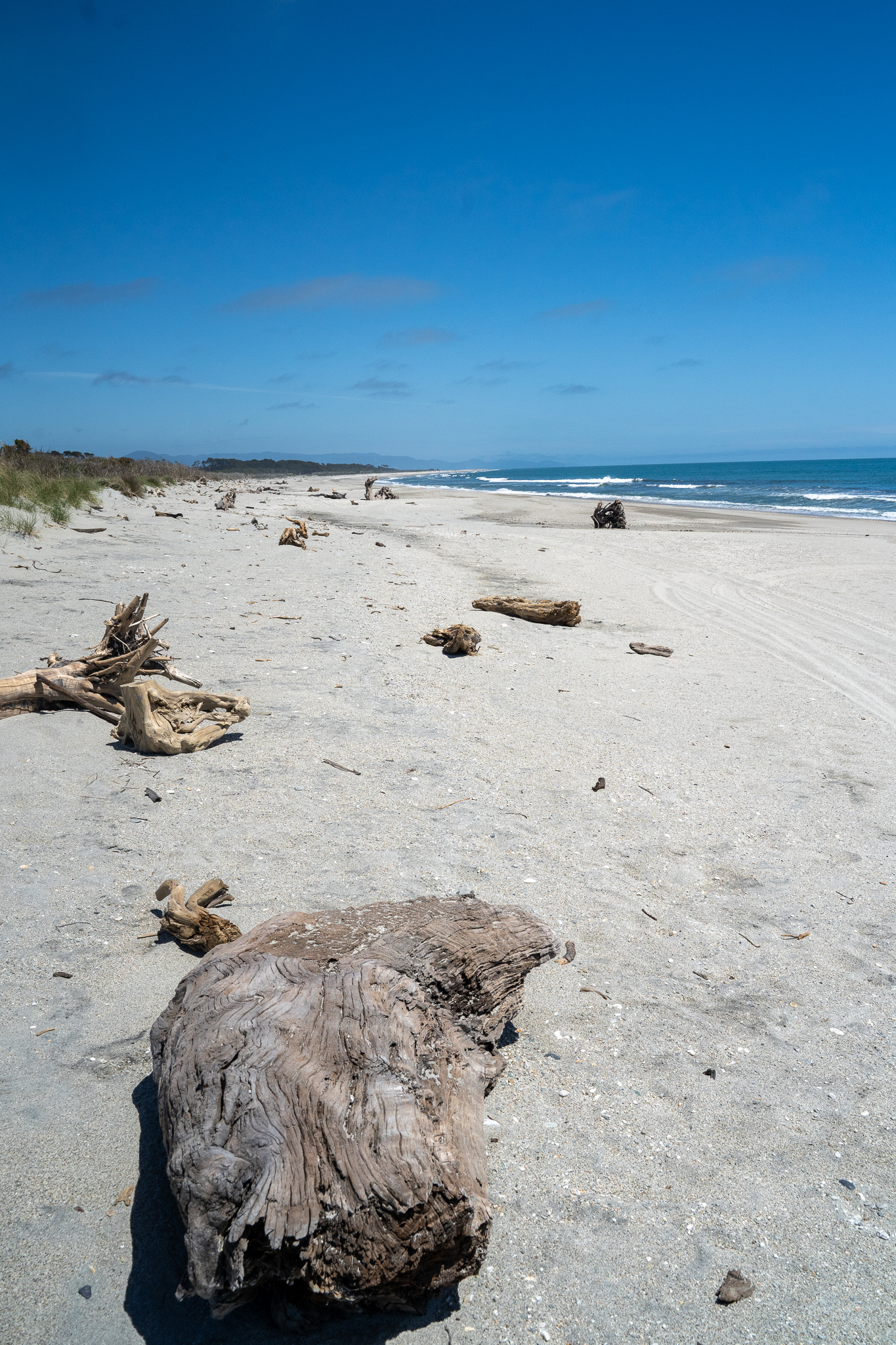
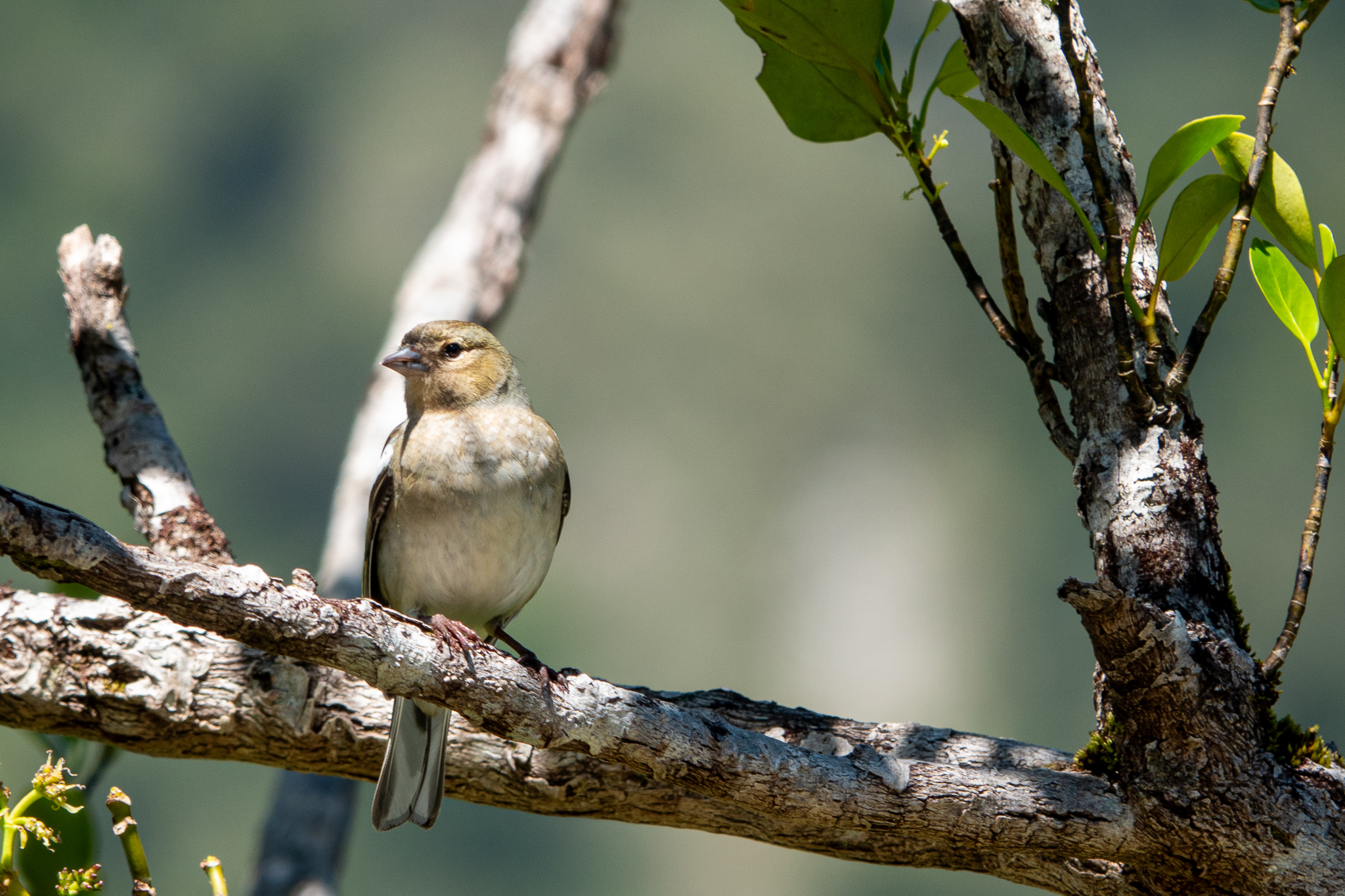
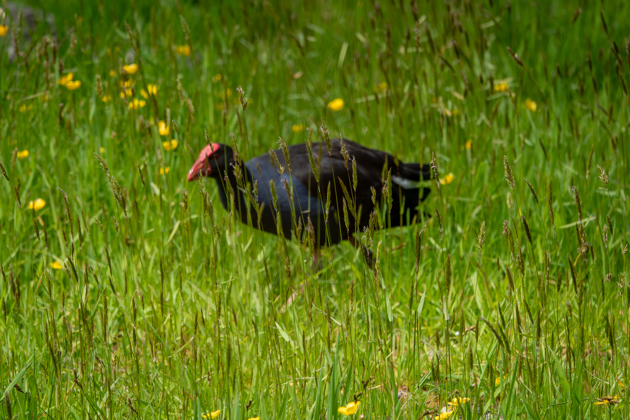
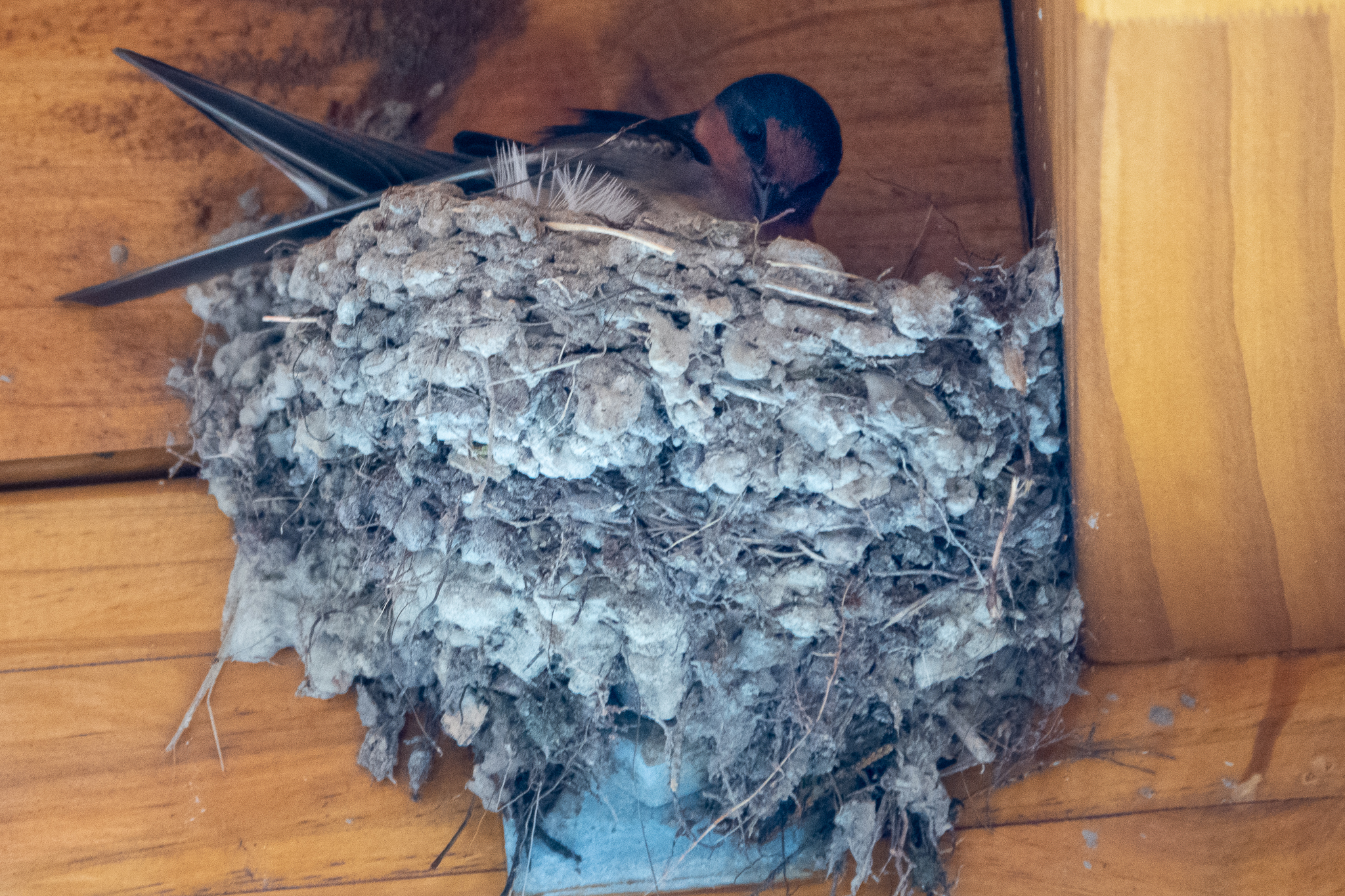
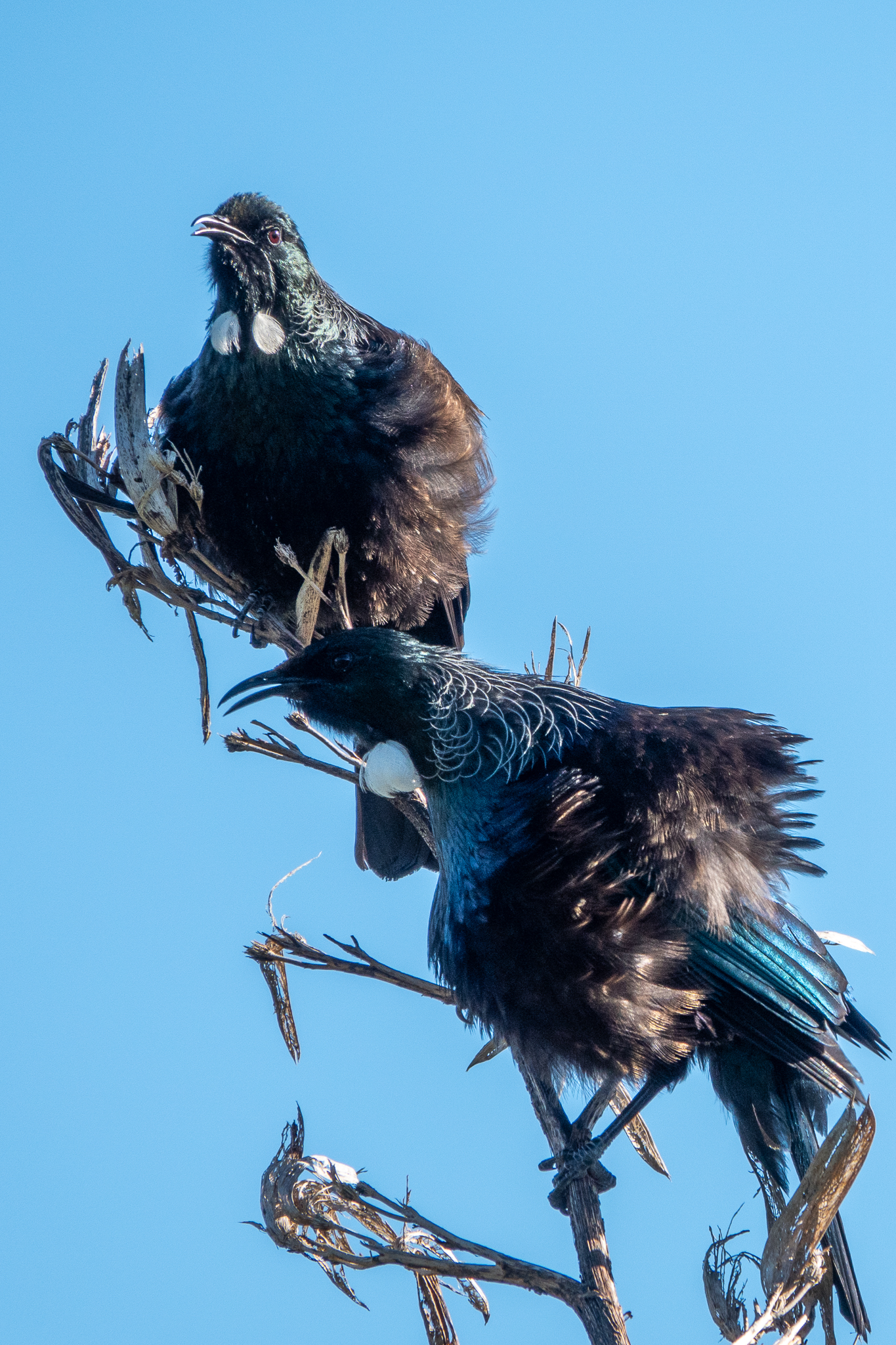
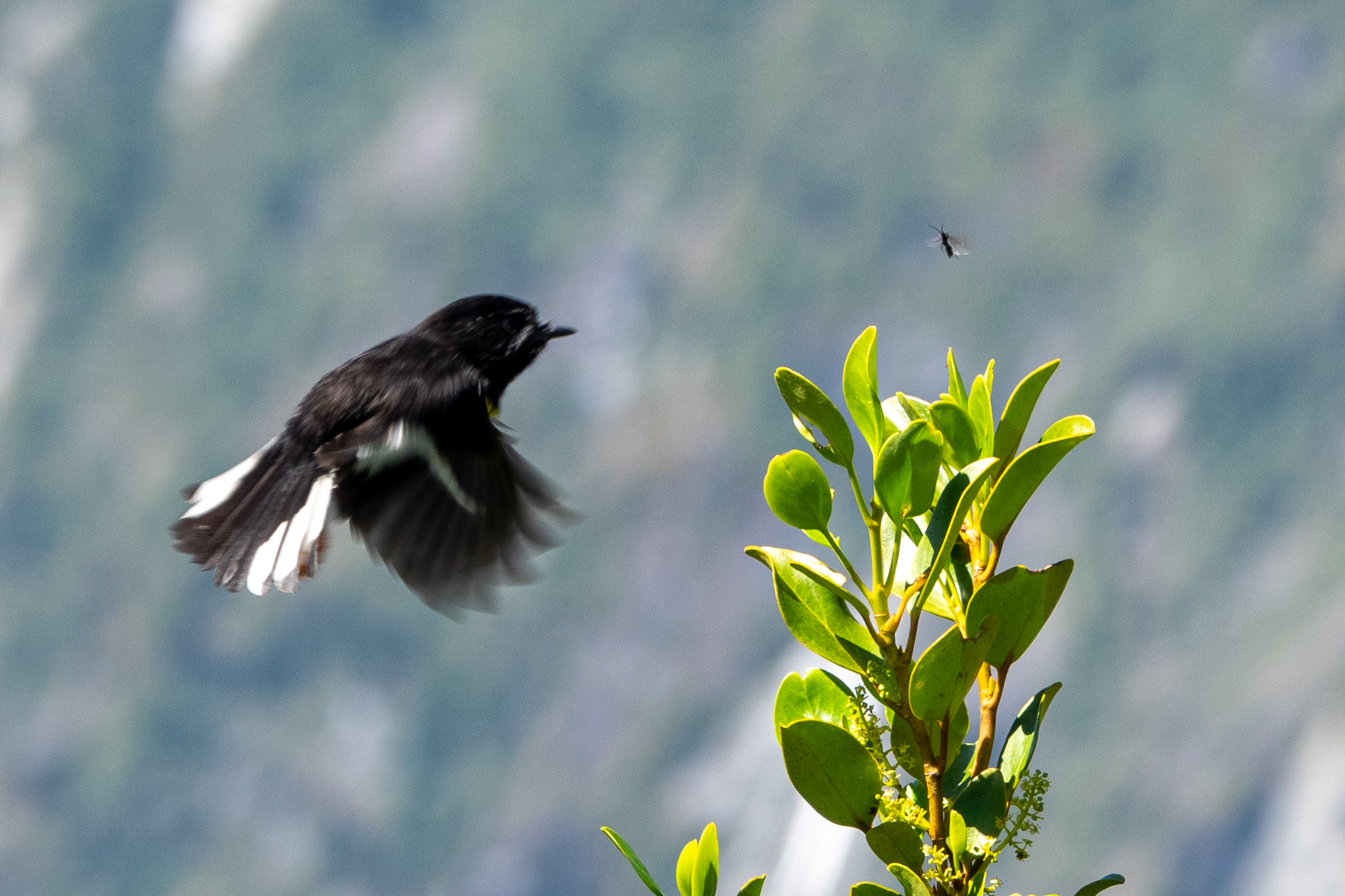
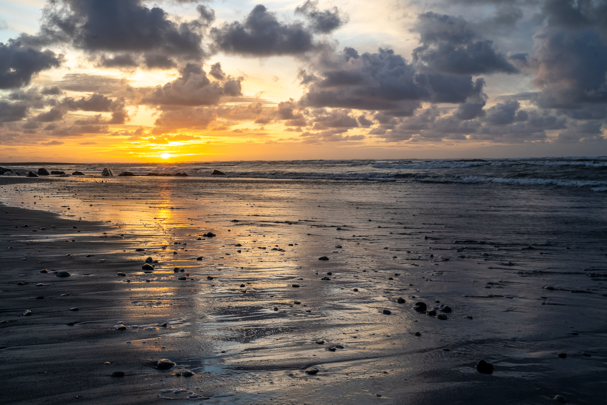
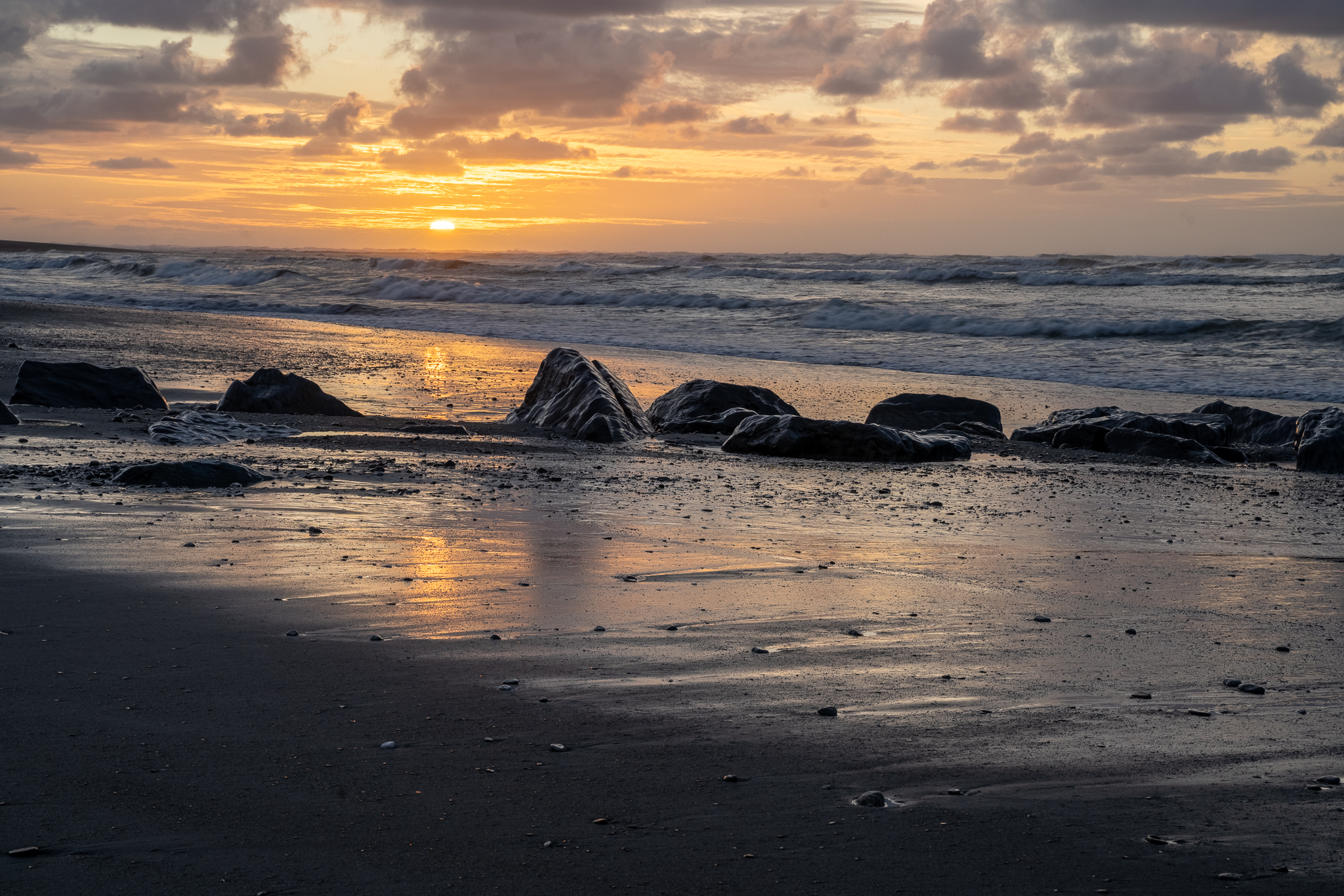
And the obligatory bird pictures – the prints inside the sand circles are Kiwi claws, still yet to see them in the wild but I have hopes for Stewart Island.
Arrived here late morning and while waiting for out first night hotel room to be ready, we first stopped at the Heritage area in town for lunch at the local market and then we headed out to Cornish Point for a walk along the side of Lake Dunstan -Lake Dunstan is a man-made lake and reservoir in the South Island of New Zealand. The lake was formed on the Clutha River as a result of the construction of the Clyde Dam, filling in four controlled stages beginning in April 1992 and completed the next year. We walked 3.5 miles out to the coffee boat and were lucky to be there, 10 minutes before it closed for the day. And then walked back to the car. We passed a number of cyclists and decided to hire some bikes for the next day and do the complete track to Clyde.
The weather was dry but overcast, which is ideal for cycling, but again a little bit of Googling last night indicated that this was no gentle path and not for the faint of heart! “The Lake Dunstan Trail links the townships of Clyde and Cromwell. The trail offers cyclists and walkers a challenging 55km ride (Grade 2-3) through unique and fascinating landscapes so characteristic of Central Otago as it journeys along Lake Dunstan, the Kawarau River and the mighty Clutha River Mata-au. This route climbs 2,837 ft with a max elevation of 1,029 ft then descends -2,940 ft. It was only recently opened in May 2021 .” Just after the coffee boat there is the highest climb with lots of narrow zig zags both on the way up and down the other side. Thank goodness we had the sense to hire EBikes but it was still a technical challenge for me as the track was very winding. I had my Garmin watch tracking and we cycled just over 27 miles then shuttled back to Cromwell. One of the things my watch does is tracks heart rate and then overlays it against gradient. It was funny to see it confirmed that my highest heart rate was not actually the climb up but further along where the path is flat, with lots of twisty bends, very narrow and with a drop off to the lake on one side. A very technical bit for me, and happy to say I negotiated it well and with plenty of encouragement from my riding coach (Rob) who was just behind me. We only took video and that needs editing so here is what someone else had to say about the ride.
We moved into our next location in Cromwell and struck gold, Hotel.com is owned by Expedia and they combine properties that are also part of VRBO, although that is not obvious when using the Hotel app. So we are in a VRBO for the next 2 nights, the lounge/kitchen area must be about 30ft by 40ft and then we have panoramic windows looking out onto a deck that is overlooking a small inlet off the lake. So today we are going to do nothing but enjoy our beautiful surroundings and just relax.
And here are the animal and flower images, ok some of the animals may not be real. It was interesting to note a few things, if you look at the vineyard image, you will see that every other gap is left free to grow wild flowers and grasses. Also not clear in the images above but all along the trail is what we thought was Heather but is actually wild Thyme and the smell was amazing.
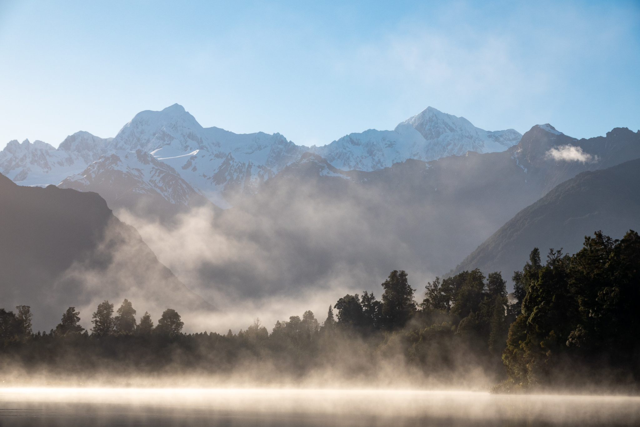
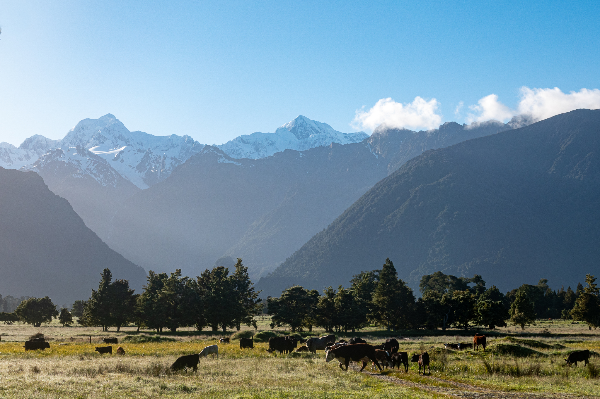
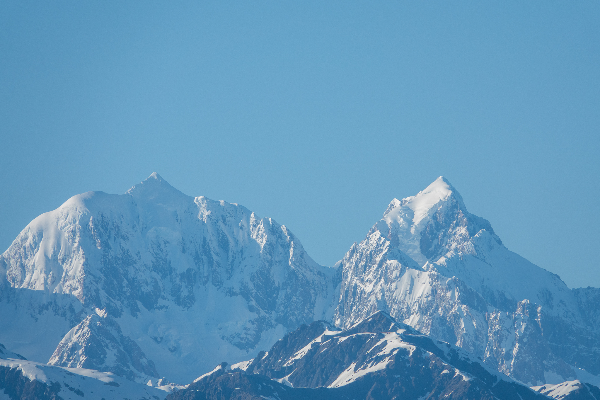
Woke up to a beautiful day in Omarama which is in a flat plain some 1500 feet above sea level and surrounded by mountains. It is also supposed to be one of the best glider plane areas in the world. We drove out to follow the road up the side of Lake Pukaki and we were treated to beautiful displays of wild Lupins along the sides of the road and then an amazing views of Mount Cook. What looked fab in the pictures from afar, the low level cloud, also convinced us a drive to the base of Mount Cook would be a waste of time.
And so after driving halfway up the side of the lake, we turned around and headed to Lake Tekapo. More views of Mount Cook and also a very nice little town and we could stop and have lunch out on a deck. We could see the famous little church that the area was also known for but there was at least 4 full size tourist buses there, and so I made do with just a long lens photo.
We drove back towards Omarama and went to visit the Clay cliffs that are just outside of town, here is the Google description The Clay Cliffs are a stark sight – tall pinnacles separated by narrow ravines. These otherworldly formations are made up of layers of gravel and silt, originally formed by the flow from ancient glaciers over a million years ago. Back into the town and a quick visit to the glider landing field to watch some of the sail planes land and at least one get towed up behind a little tow plane
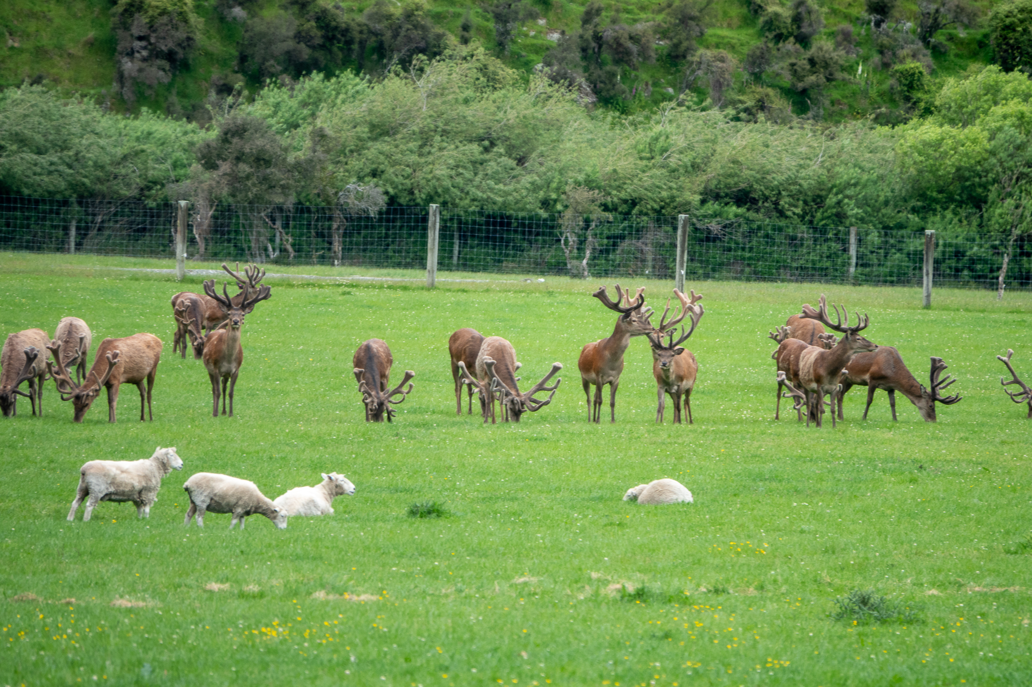
More animals and some of the thousands of bee hives we have seen everywhere this trip
What we have found over and over again on this trip, is that casual conversations with locals, has us going to places that were not on our original list. This was the case in Wanaka. At the top of Iron mountain yesterday, a gentleman recommended a drive out to Raspberry Flats and then when we checked into our accommodation (which turned out to be a very nice VRBO) he asked if we were planning to climb Roy’s Peak. Rob looked it up and we thought the Peak would be a challenge but we would give it a go.
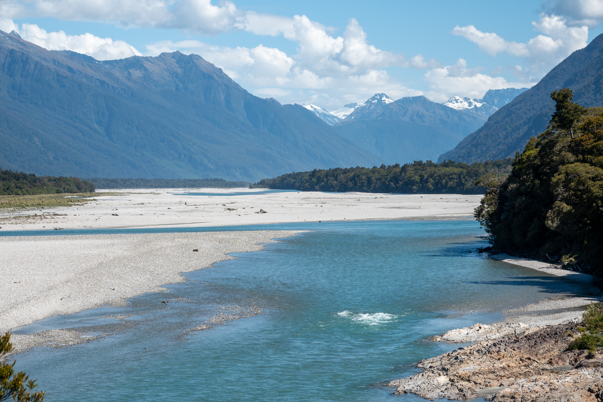
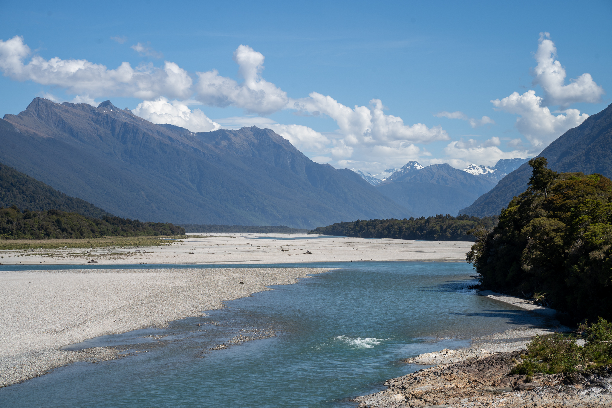
Next morning the weather was raining at the start and the weather forecast predicted really high winds coming in later in the day. So we decided that Roy’s Peak was not a good idea and we would drive up to Raspberry Flats. The last 18 miles of that trip are on gravel tracks and through small fords so to say it was interesting was an under statement. When we got to the end there was the ability to hike up the valley, the scenery was stunning and we were able to see part of Mt Aspiring Glacier. But, as most of you saw from the video Rob posted on Facebook, the predicted winds were very strong and it was as much as I could do to stay on my feet. We just walked up 2.5 miles and then returned to the car. It was definitely worth the trip.
Next morning we were planning to check out of our rooms and then go and do Roy’s Peak. Wow, what an experience, here is what the Google has to say: “Roy’s Peak is a medium to hard difficult day hike. It involves a large elevation climb of 1,258 meters (4,127 feet) and in total is 16 kilometers (10 miles) long. You need to be reasonably fit to complete the track.” That’s 5 miles up and 5 miles back down. We experienced sunshine, medium winds, occasional light rain and up at the top we actually had some snow falling on us. The views were amazing, a lot of people stop about a mile before the top as there is a spot where a lot of Instagram photos are taken. But these hardy souls pushed on to the true peak. Although for the last 500 yards we took different routes. Rob did the incredibly thin ridge walk and I did the zig zag track. In total it took us 5.5 hours and I was incredibly proud of our achievement. We were pretty tired but drove on to Omarama, early dinner and then collapse into bed.
No blog would be complete, in my opinion, without some animal images
We had a lazy day as our last day in Fox Glacier gentle walk close to the hotel, early lunch and dinner and a walk over to see the glow worms, this was somewhat spoilt by a coach party of tourists that did not understand the need for darkness and were walking around with torches!
Up early the next morning and heading off to Haast rain first thing and then it cleared up nicely with a few stops at Knights Point and Ship Creek before we arrived at Haast. We passed a husband a wife team cycling, twice along the way, first between Knights Point and and Ship Creek, and buy the time we took a quick walk and got back on the road we were able to pass them again.
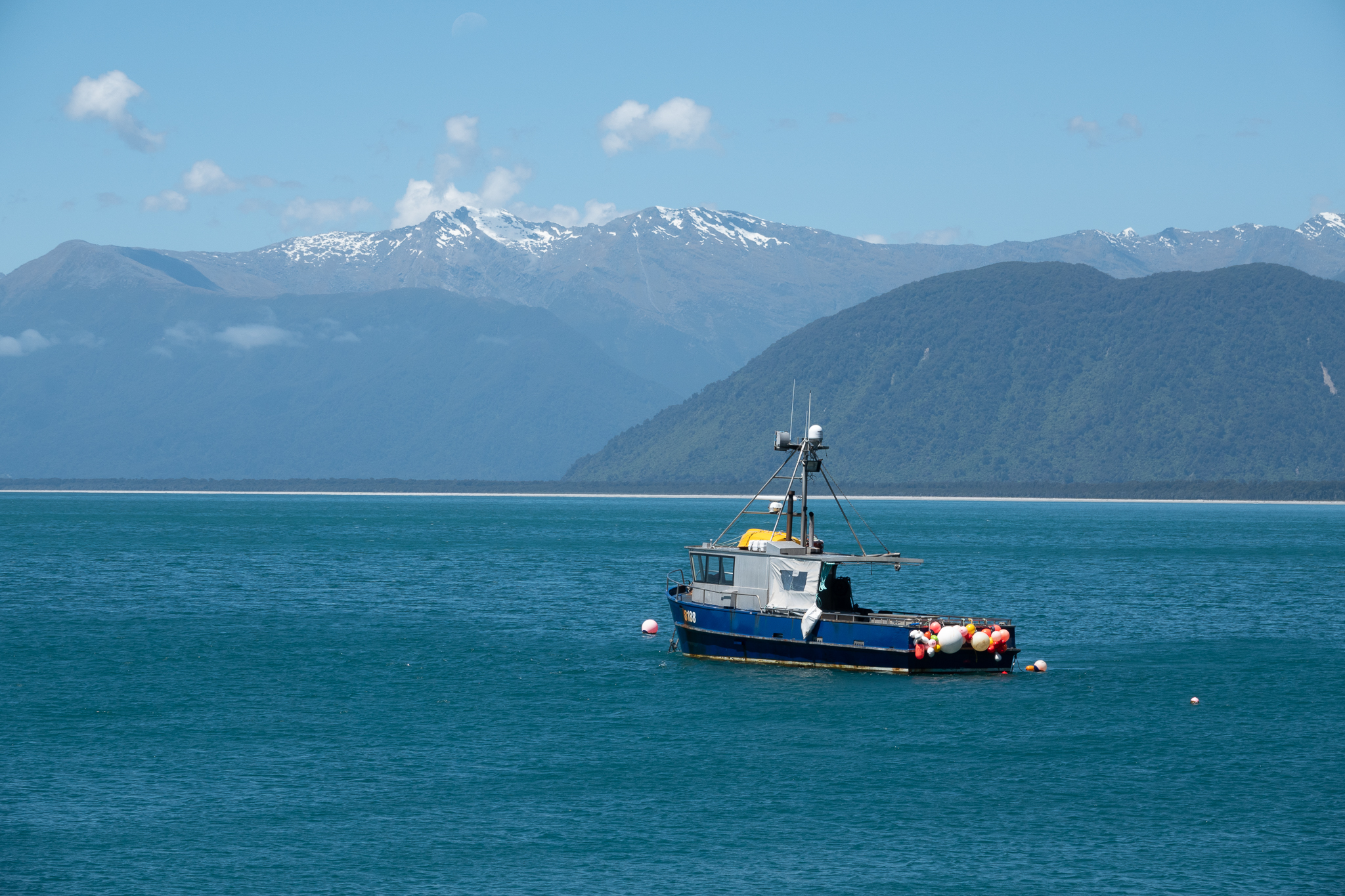
When we got to Haast we were a bit surprised just how small it was, one pub/restaurant and one grocery store/cafe and just a few houses and farms. We took a ride along to Jackson bay and walked over the headland there and then settled into our motel for the night.
Next morning we headed to Wanaka and decided to stop at every walk and photo spot along the way. Imagine our surprise to see the two cyclists again and yes after a 30 min walk at one of the lookouts we could not believe our eyes, it was our cyclists. We pulled into a restaurant to get lunch and Rob said wouldn’t be funny if they came in after us and yes they did! I went over to congratulate them and tell them how many times they had caught up to us. And lets just say, they were not spring chickens. We still were in Wanaka by early afternoon and do we took a walk up Iron Mountain and were treated to quite a steep walk but the view from the top was well worth it. We later checked into our place and were pleasantly surprised with great views of the lake, a really nice place and a fully stocked kitchen, including a nice bottle of wine, home made muffins and lots of other treats. We walked into town for dinner and then back for an early night.
Leaving Hokitika with overcast and rainy weather. This continued all the way down the coast to Franz Joseph, so we had a quick lunch visited the local tourist office and also called in to a Kiwi Sanctuary to find out about all the work thats happening over here to aid their conservation and one of the many ways they are doing this is to control the predators that were introduced to the country, Stoats and rats
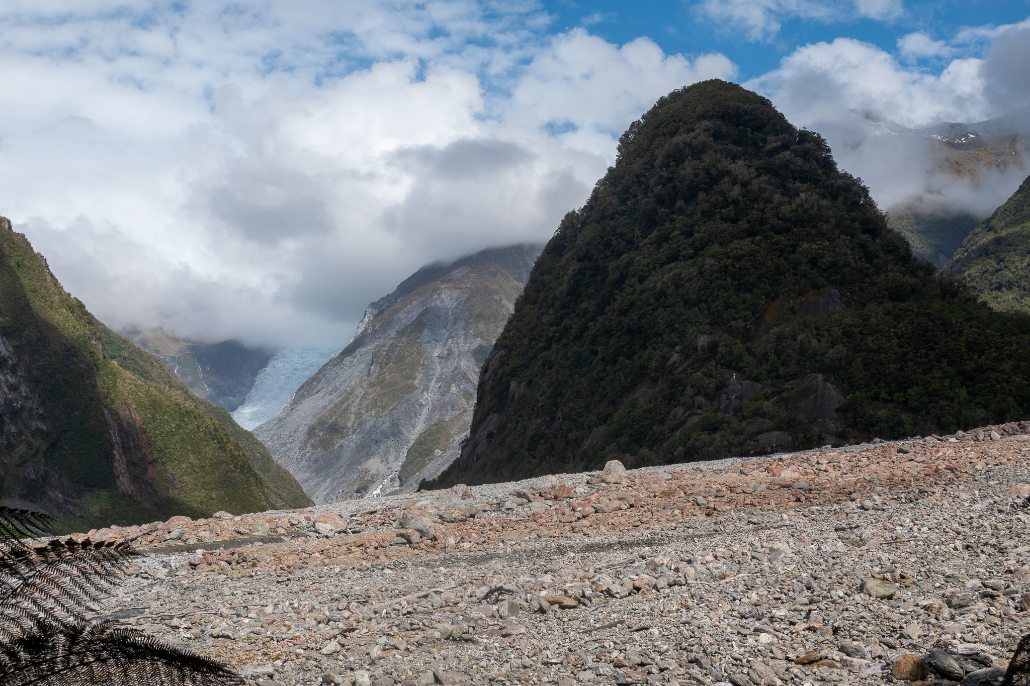
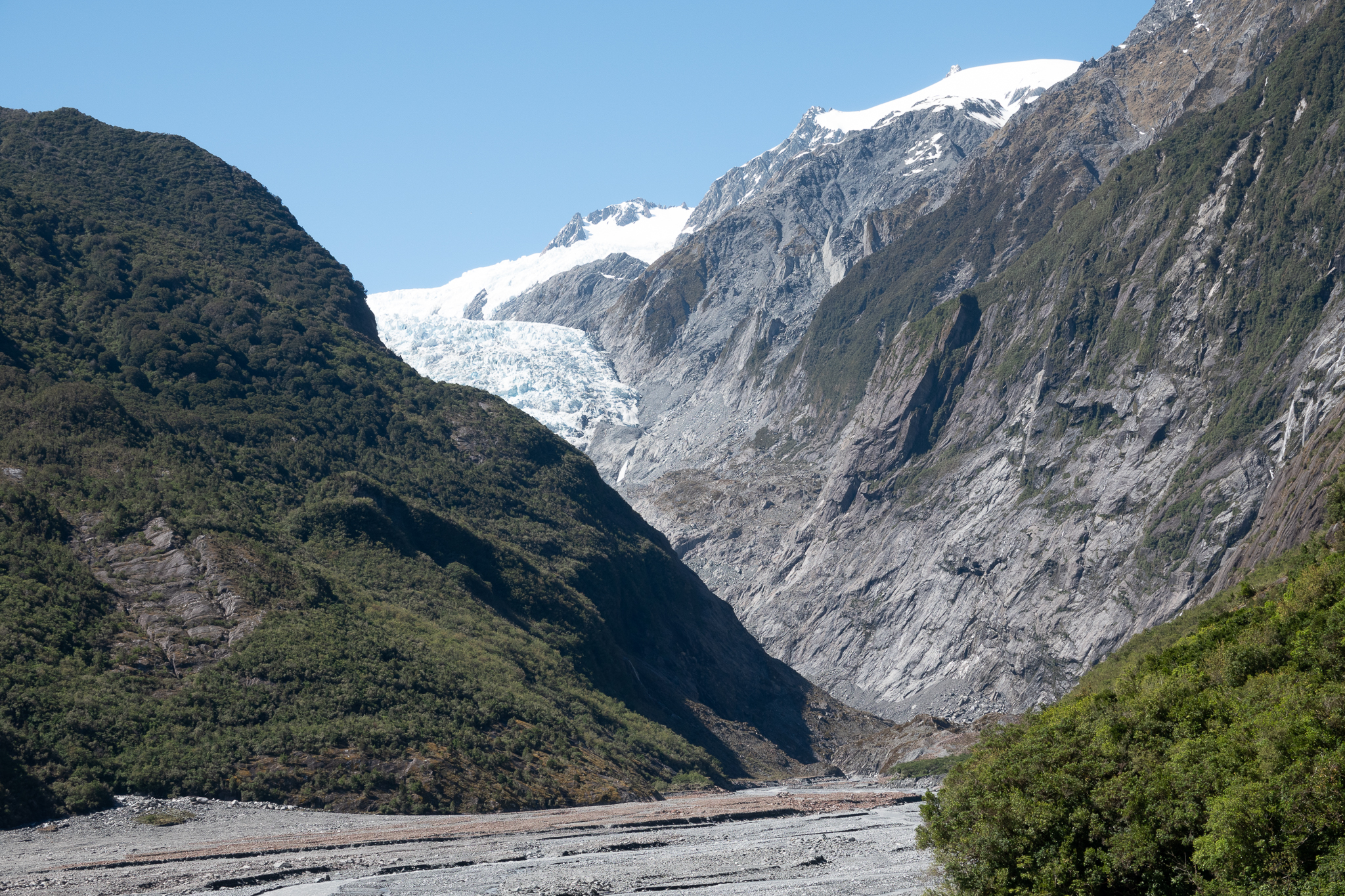
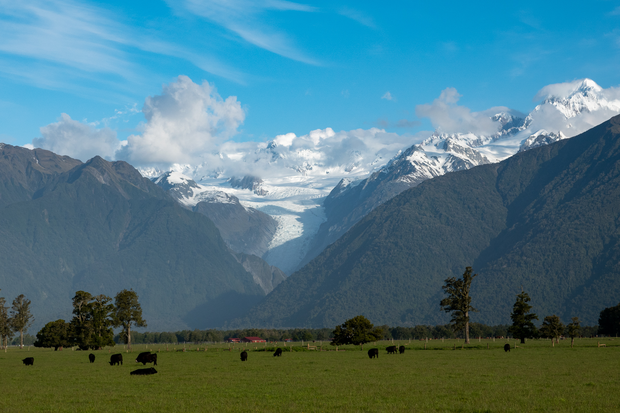
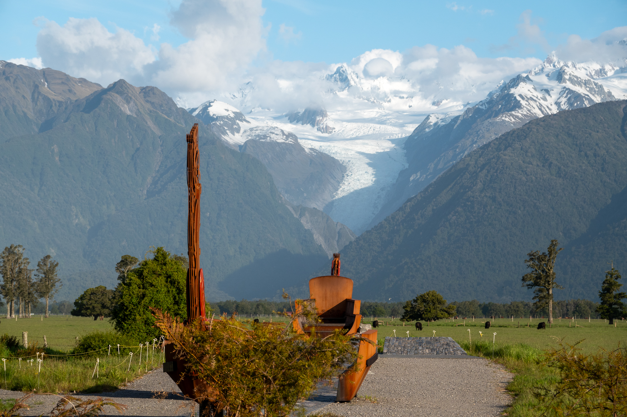
By the time we came out the weather had dried and we drove on down to Fox Glacier where we were staying for another 4 nights. That evening we walked up to the lookout for Fox Glacier a nice pleasant walk and a great view.
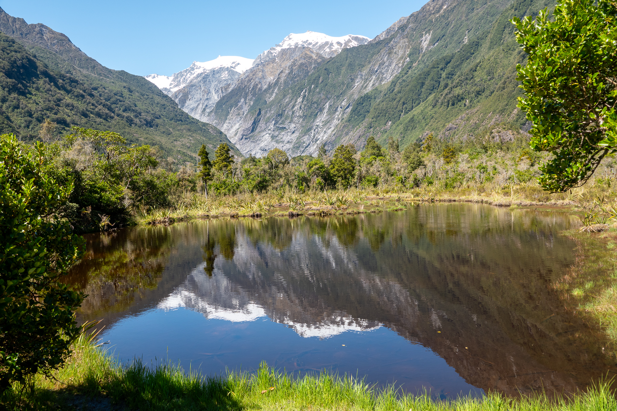
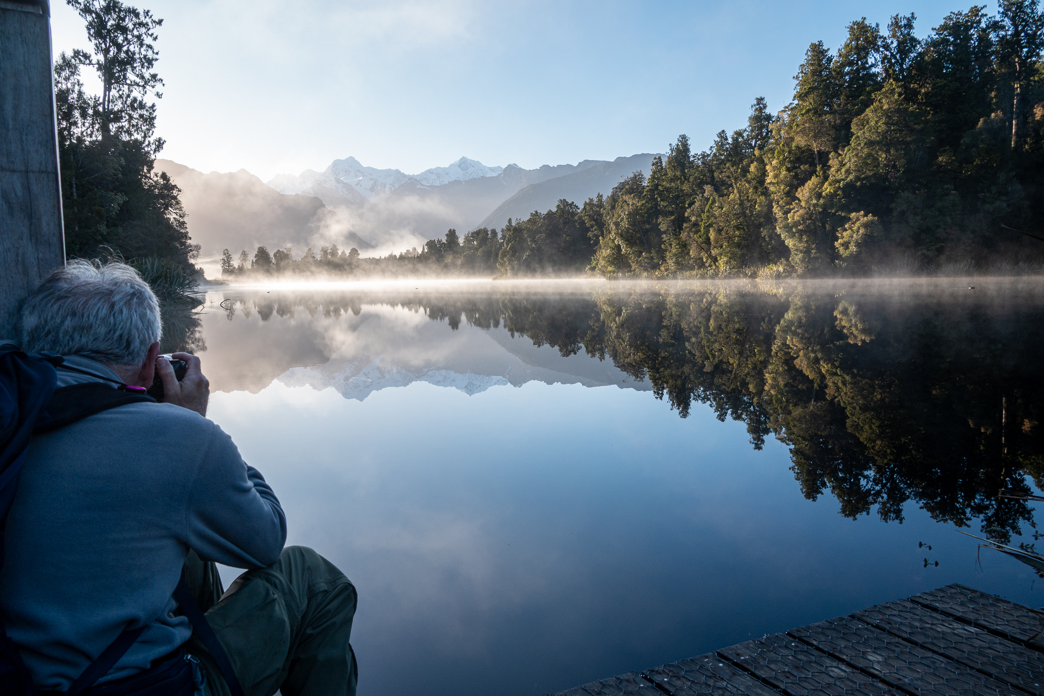
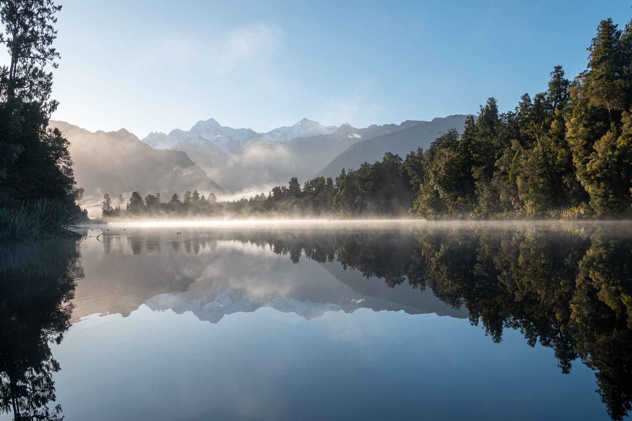
Next day Rob woke me up just before 6, I quickly pointed out the error of his ways, no issue with the time, but he did not have a cup of coffee ready for me and ws insisting we left right away! On the upside, we had stunning views of Mount Tasman and Mount Cook also perfect reflections of both mountains in Lake Matheson. Back to the hotel for a belated breakfast and then back over to Lake Matheson and a hike over the mountain to lake Gault. There was a young man there from Australia who was about to dive in the Lake, he confirmed our thoughts as declared it freezing.
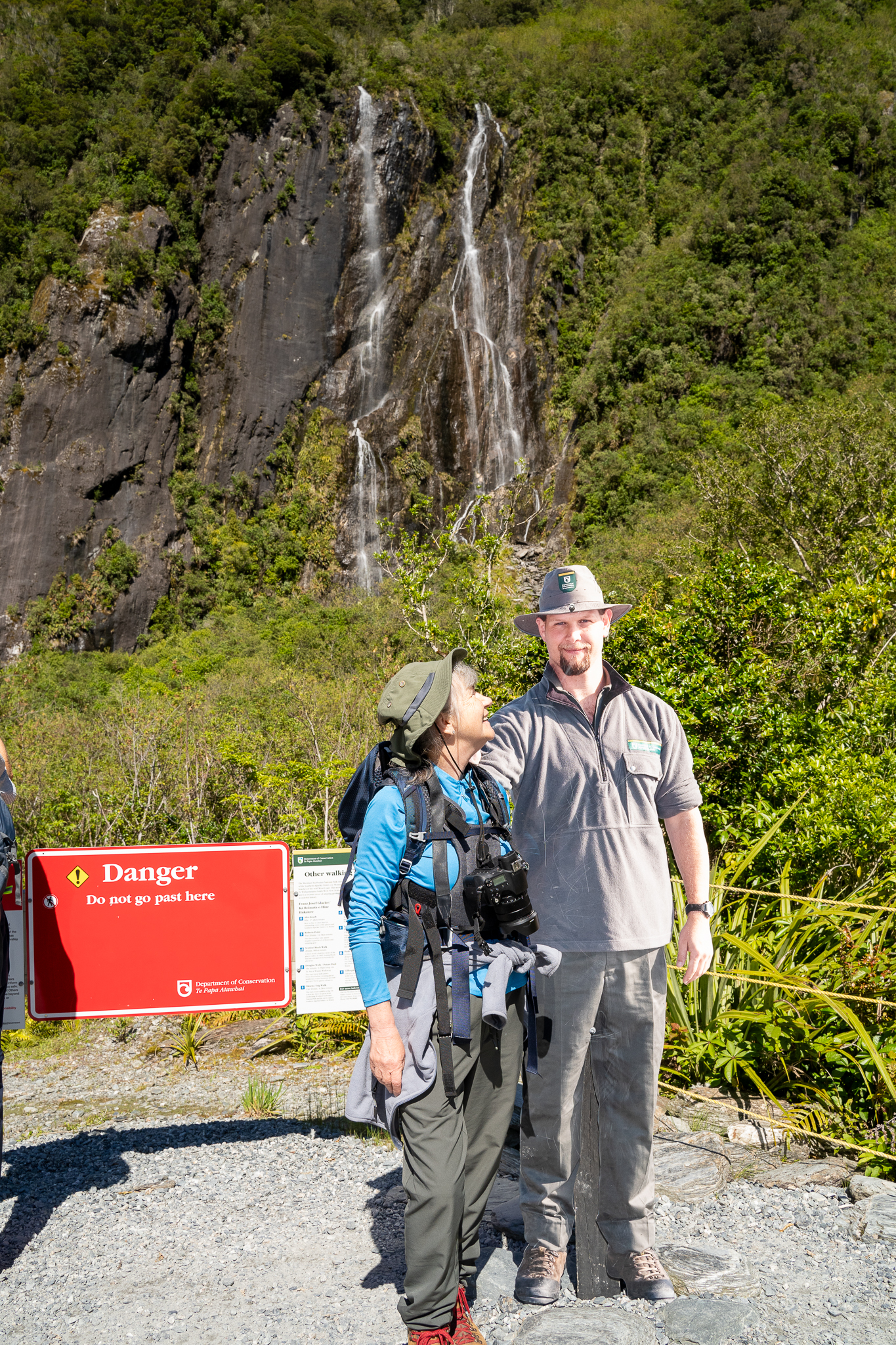
Later that afternoon we took another small hike to look out at the largest active land slip in New Zealand, it’s been on the move for many years and heavy rain still brings more of it down.
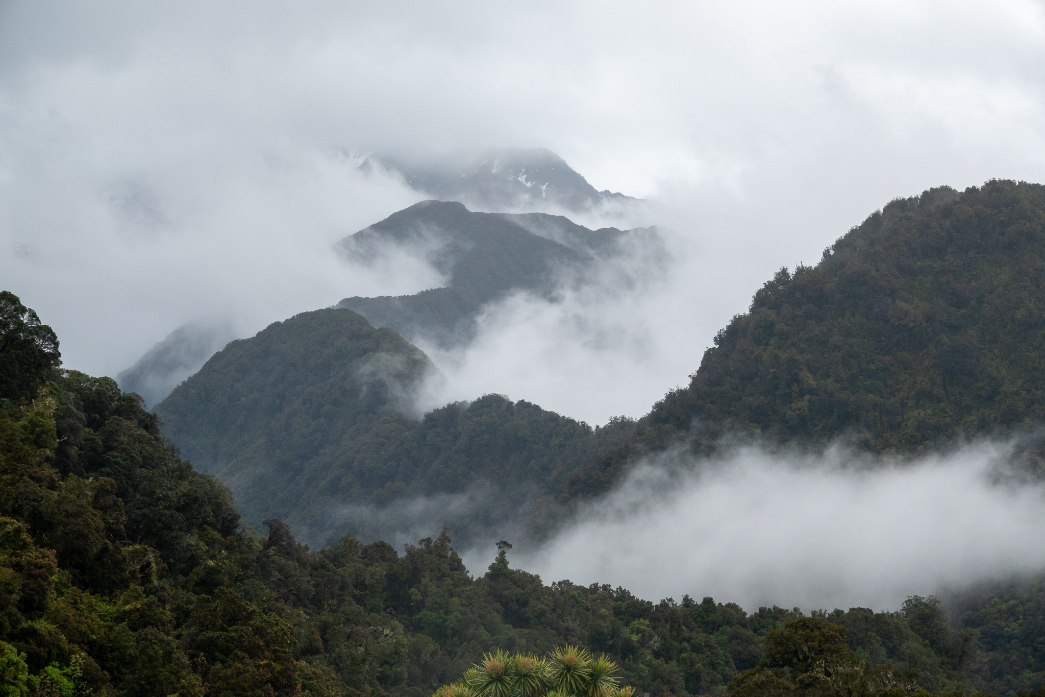
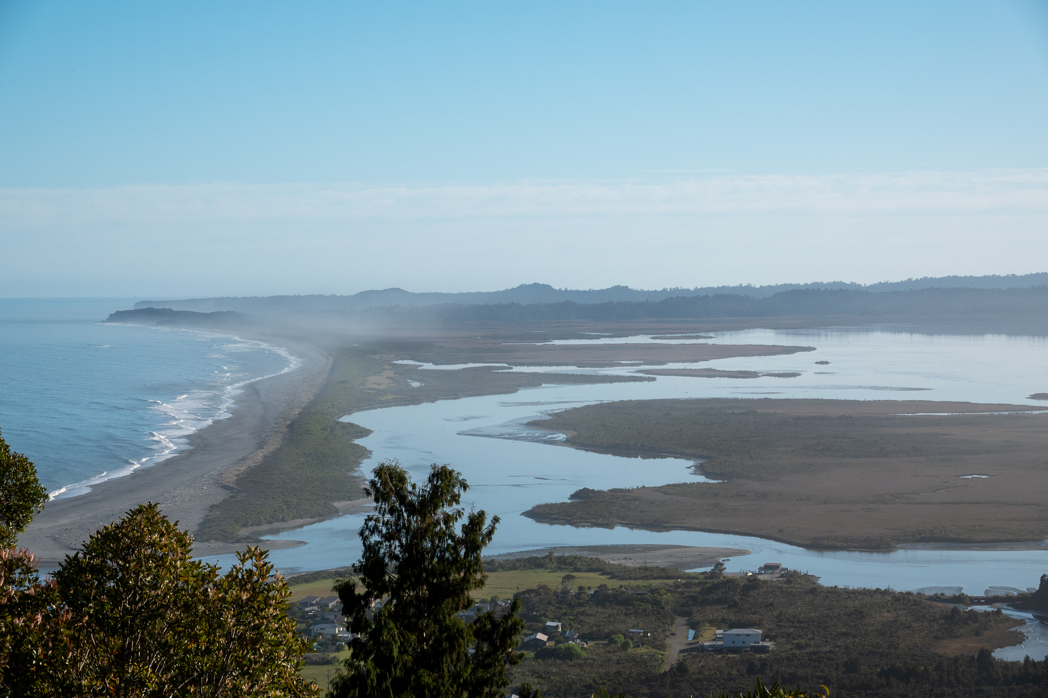
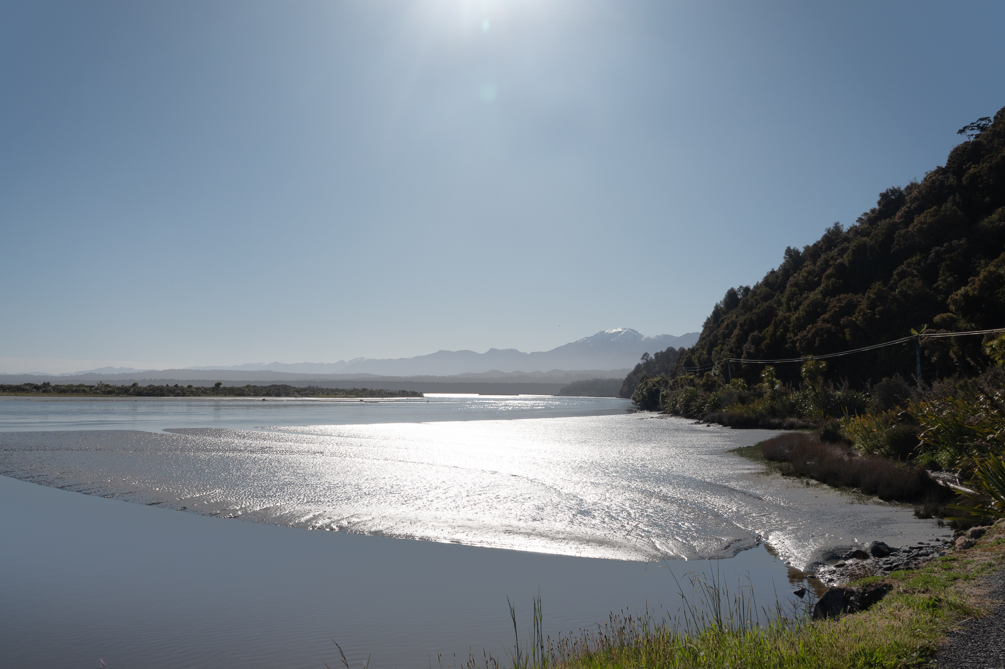
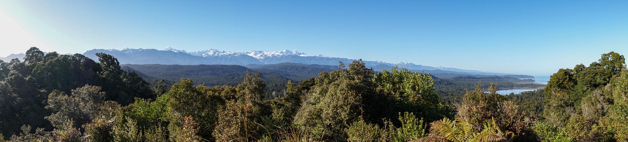
Ok the next morning Rob had learned his lesson – woke me at 5.45 with a coffee cup in his hand and then we drove over to Okarito to walk up the the trig point. The drive over the mountain was very eerie as there was a combination of mist rising from the valleys and also low cloud. By the time we got to Okarito it had started to clear up and we hiked up to the trig point where we were spoilt with magnificent views of the alpine range.
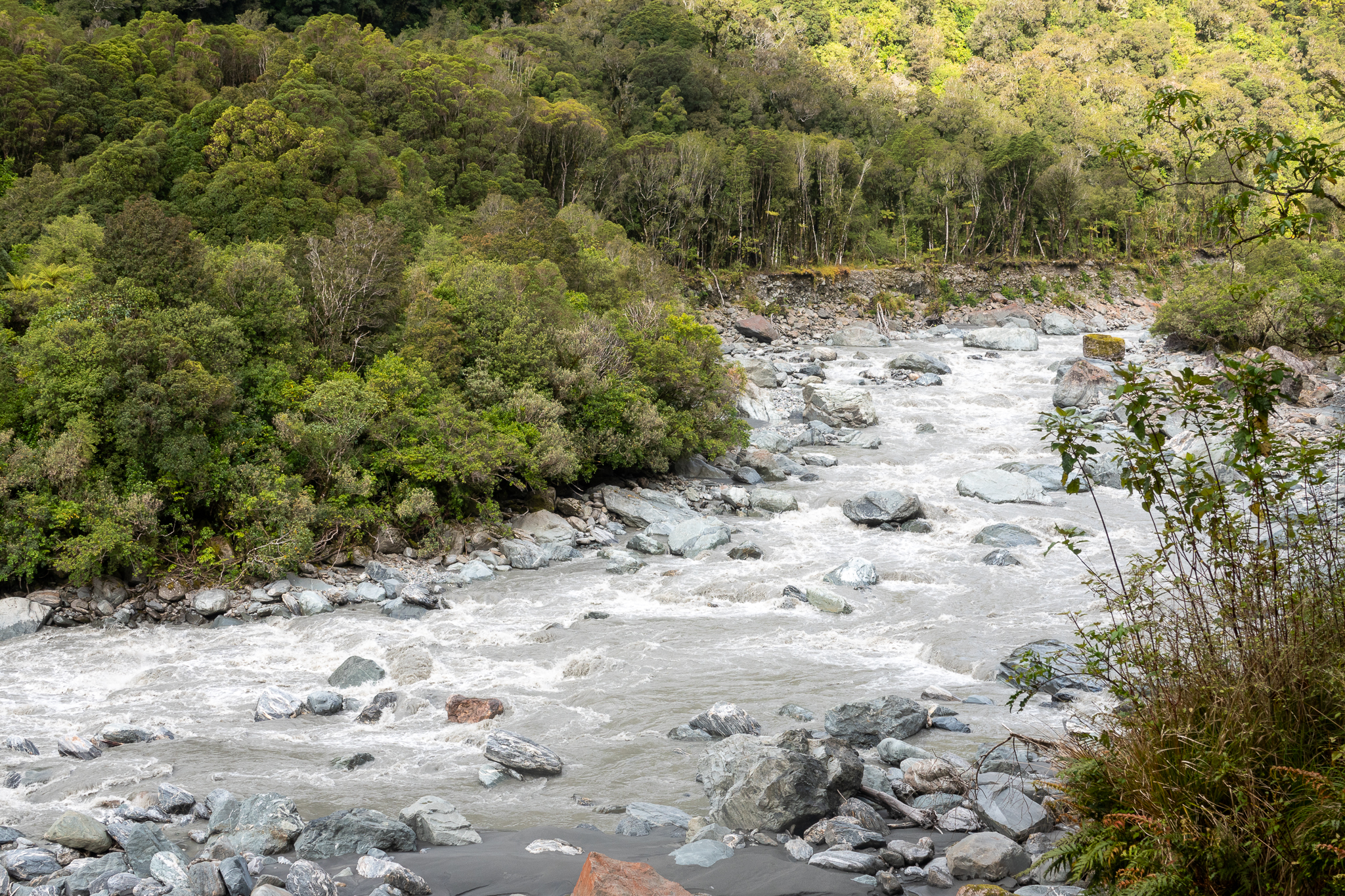
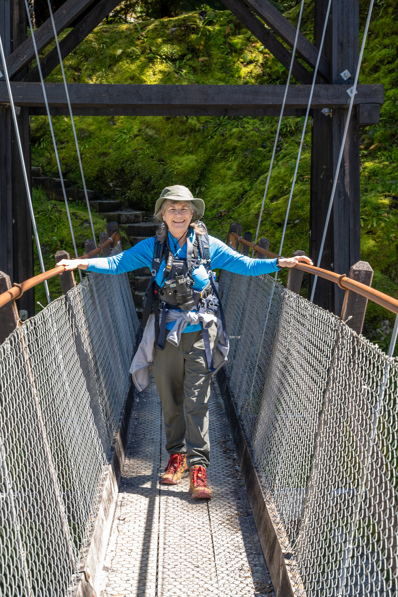
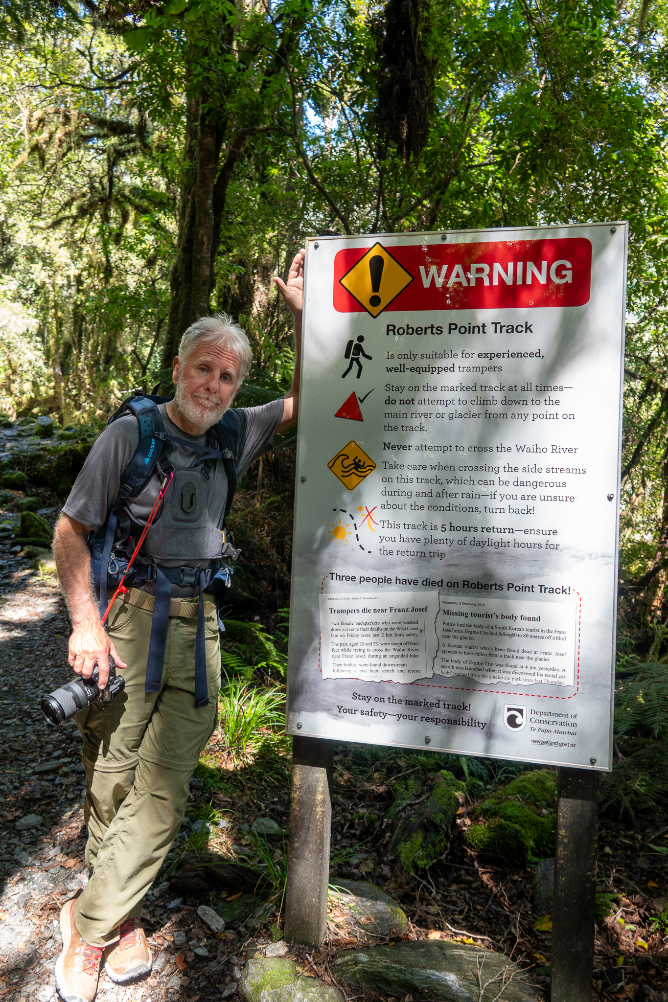
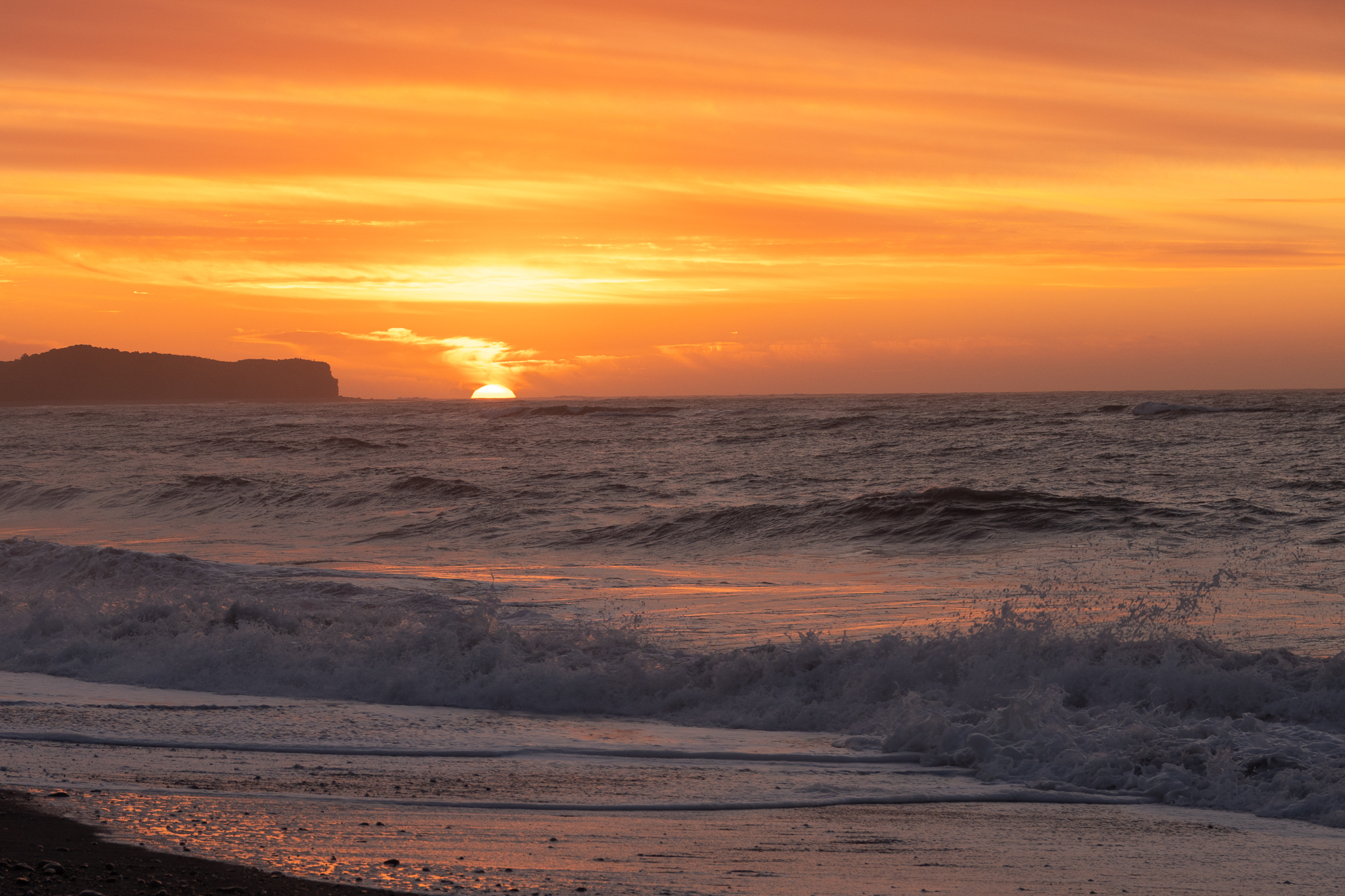
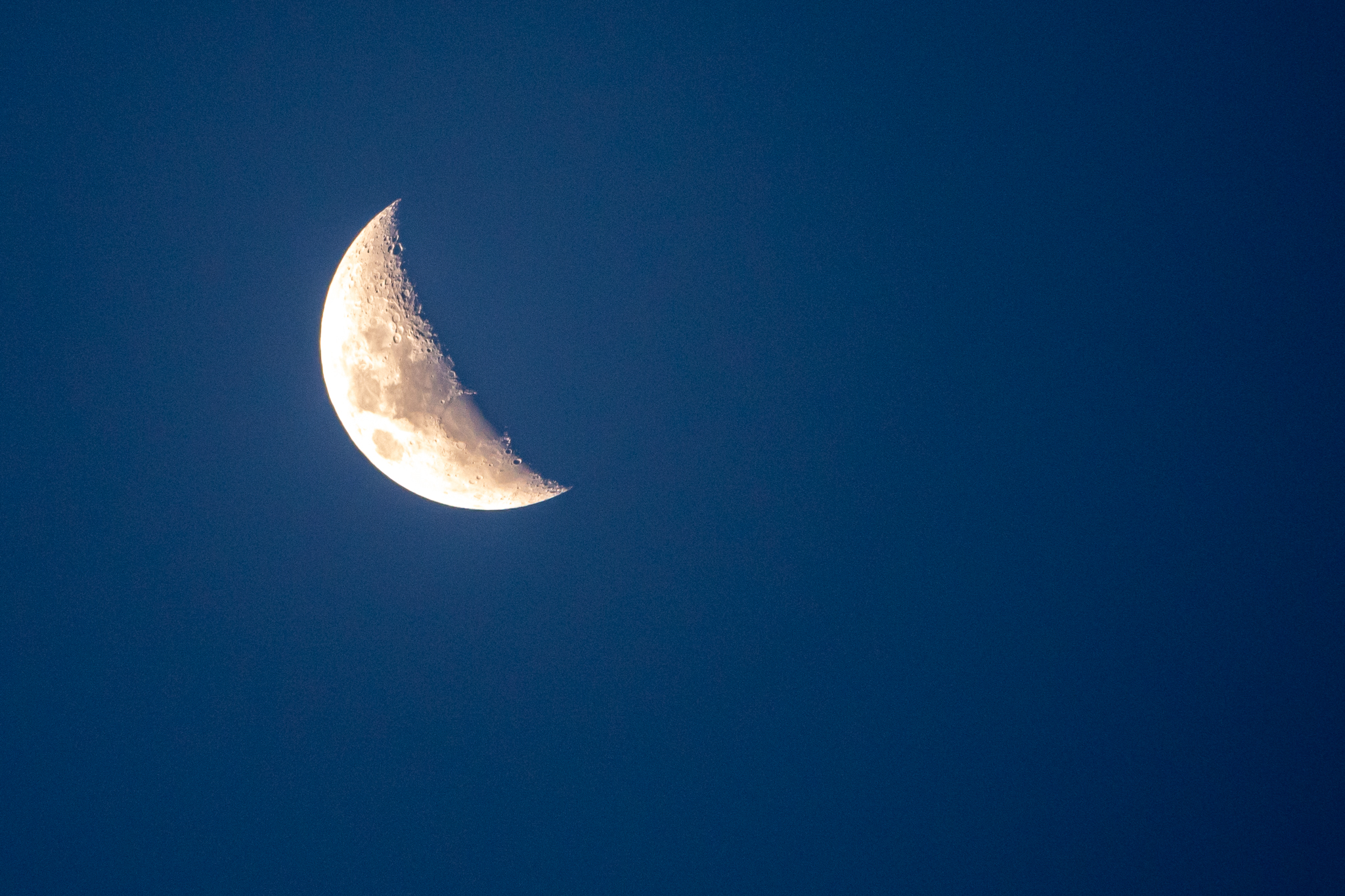
We drove back to Franz Joseph and stitched together a number of walks around the Franz Joseph glacier valley as well as a walk up to Lake Wombat, I have to say although the walk up was quite challenging the lake itself was a disappointment and was about the only time neither of us found anything there to photograph. After an early dinner we headed off to a Fox Glacier lookout point that was much better than expected. We then drove 6 miles down to Gillespie beach, this was another “interesting drive” as it was a gravel road, slightly wider than a single track and with many twists and turns. It turned out to be a worthwhile journey as we were treated to another lovely sunset and also views on the some of the alpine range bathed in the warm sunset light. Rob also challenged me to take a photo of the moon with my camera and as you can see below, the result was pretty good, especially as I hand held it. The drive back in the dark was even more interesting and we had to drive slow so that we could any Kiwi’s if they were out an about.
No post would be complete without animal and arty shots
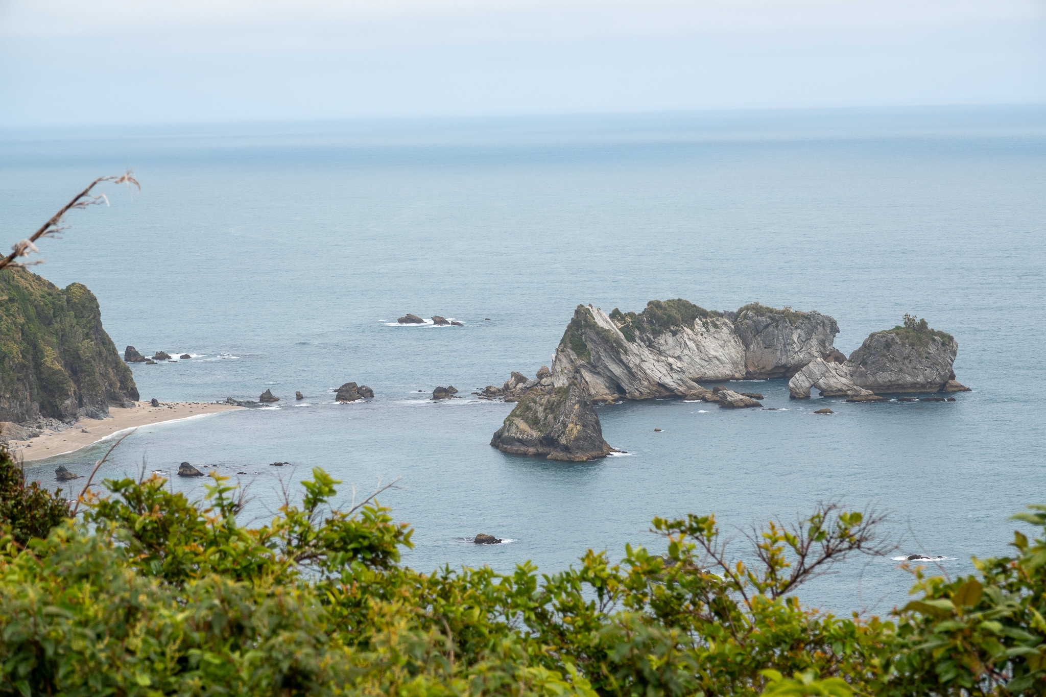
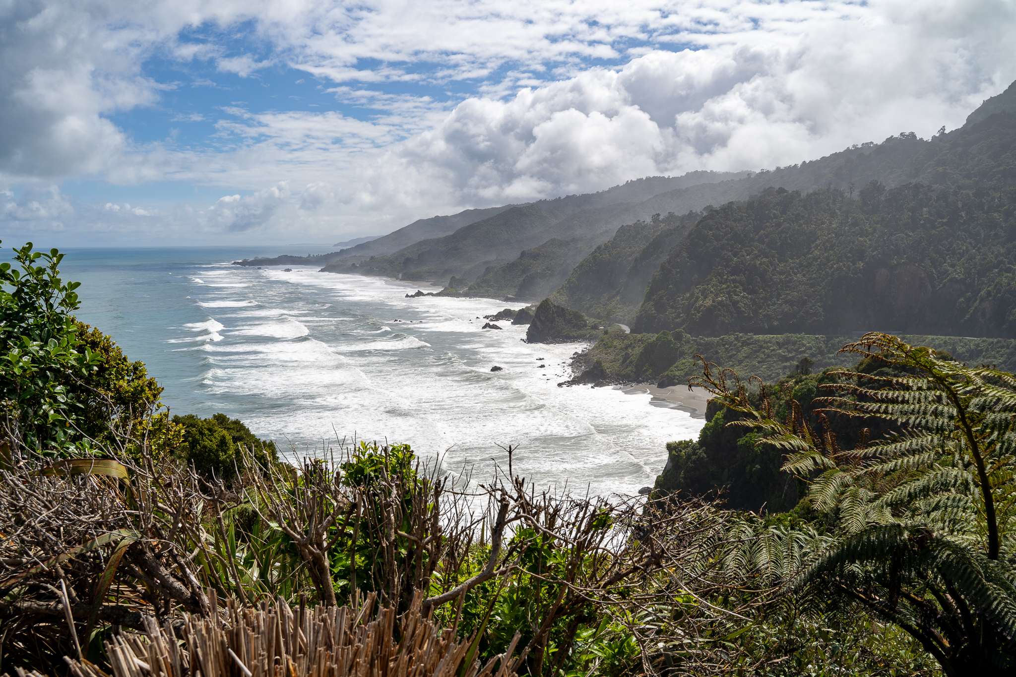
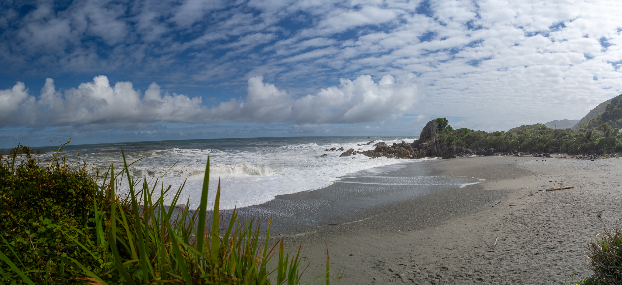
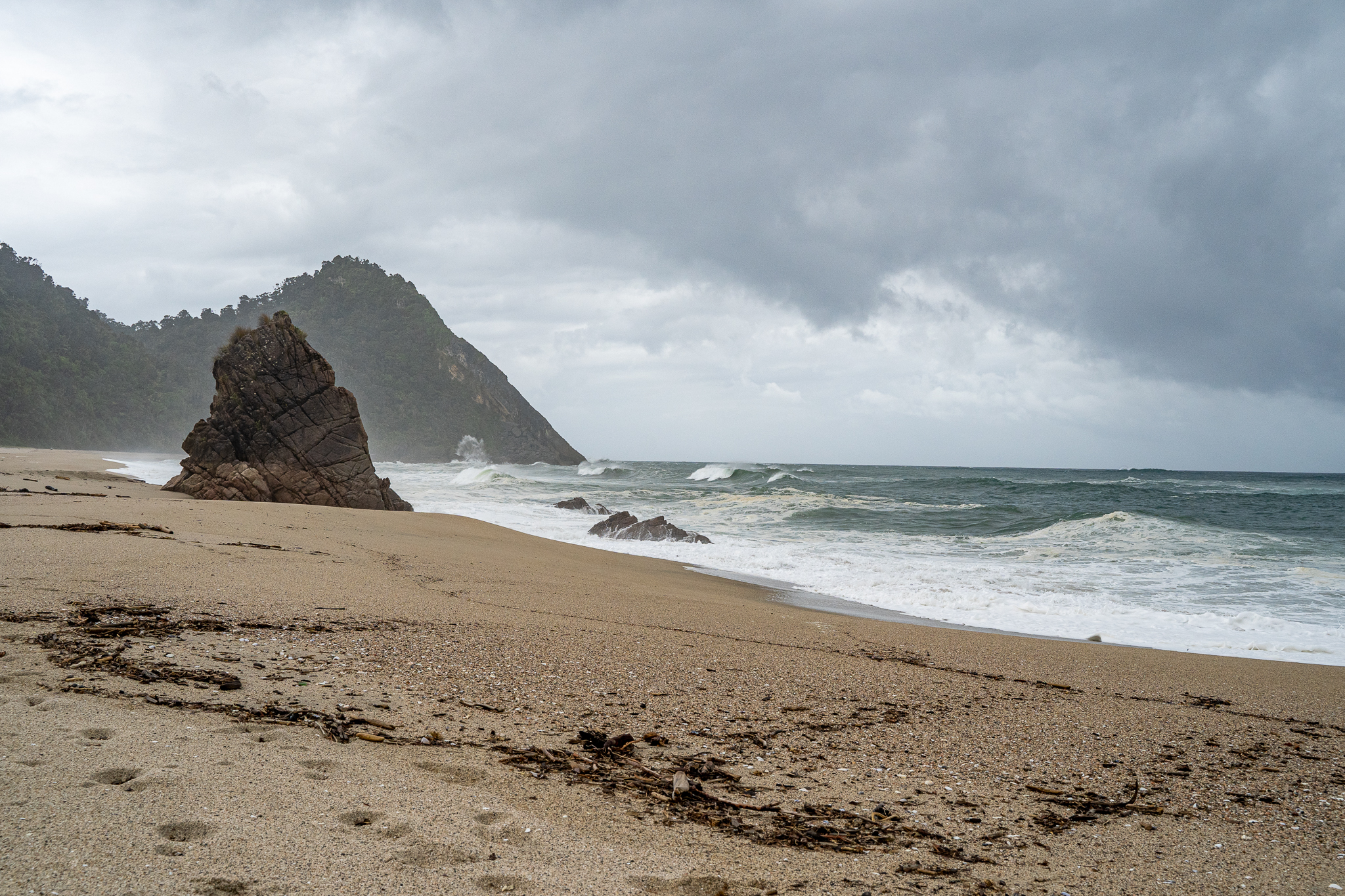
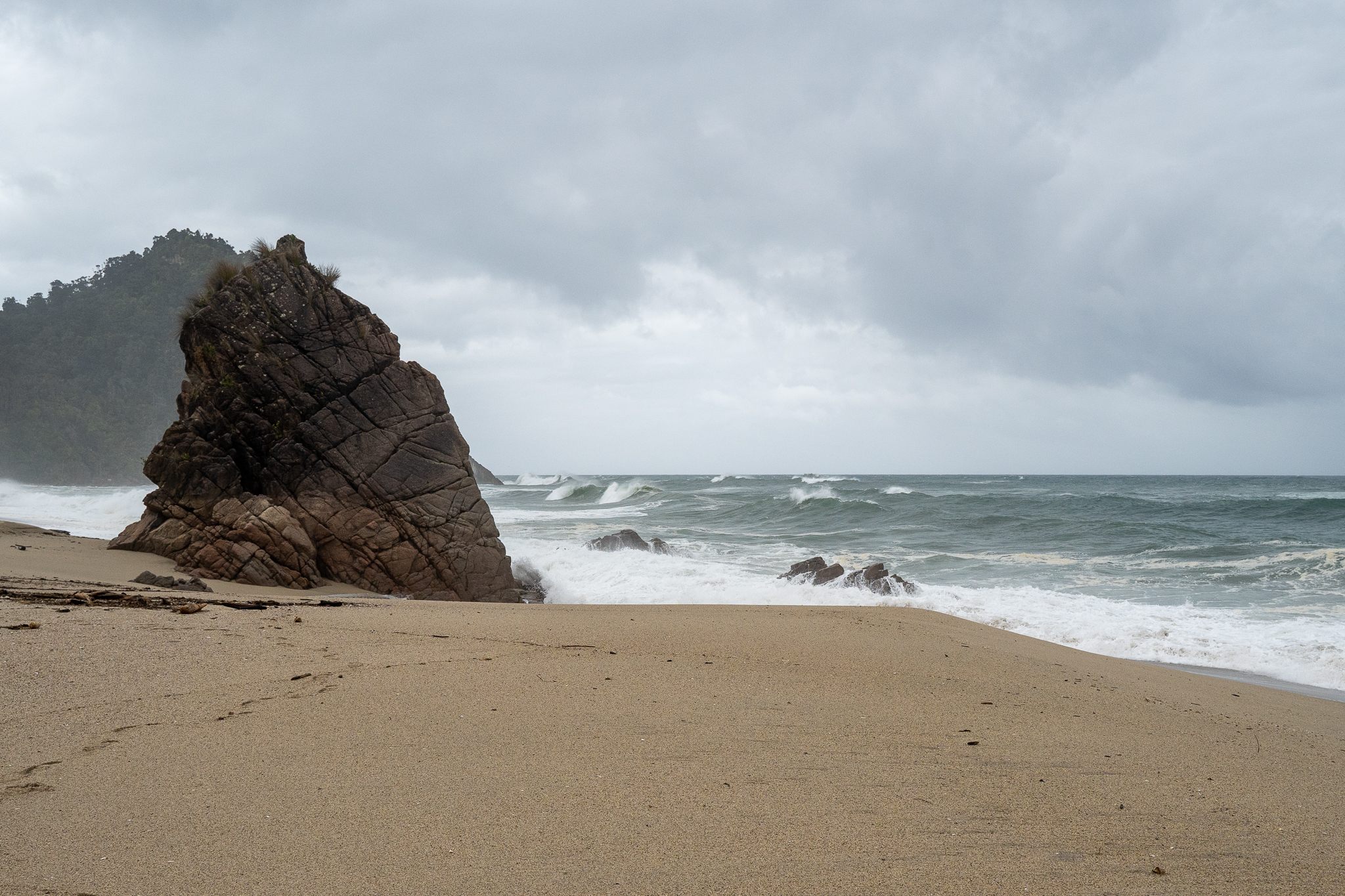
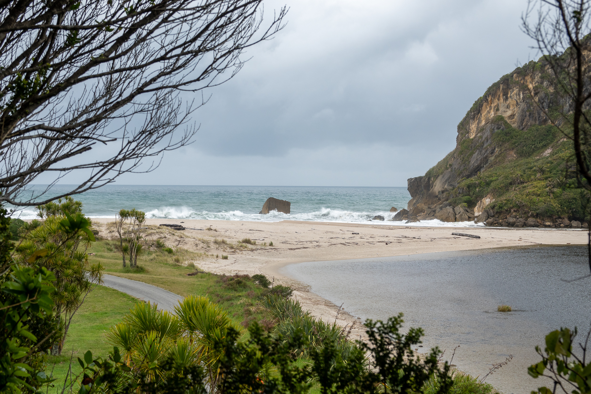
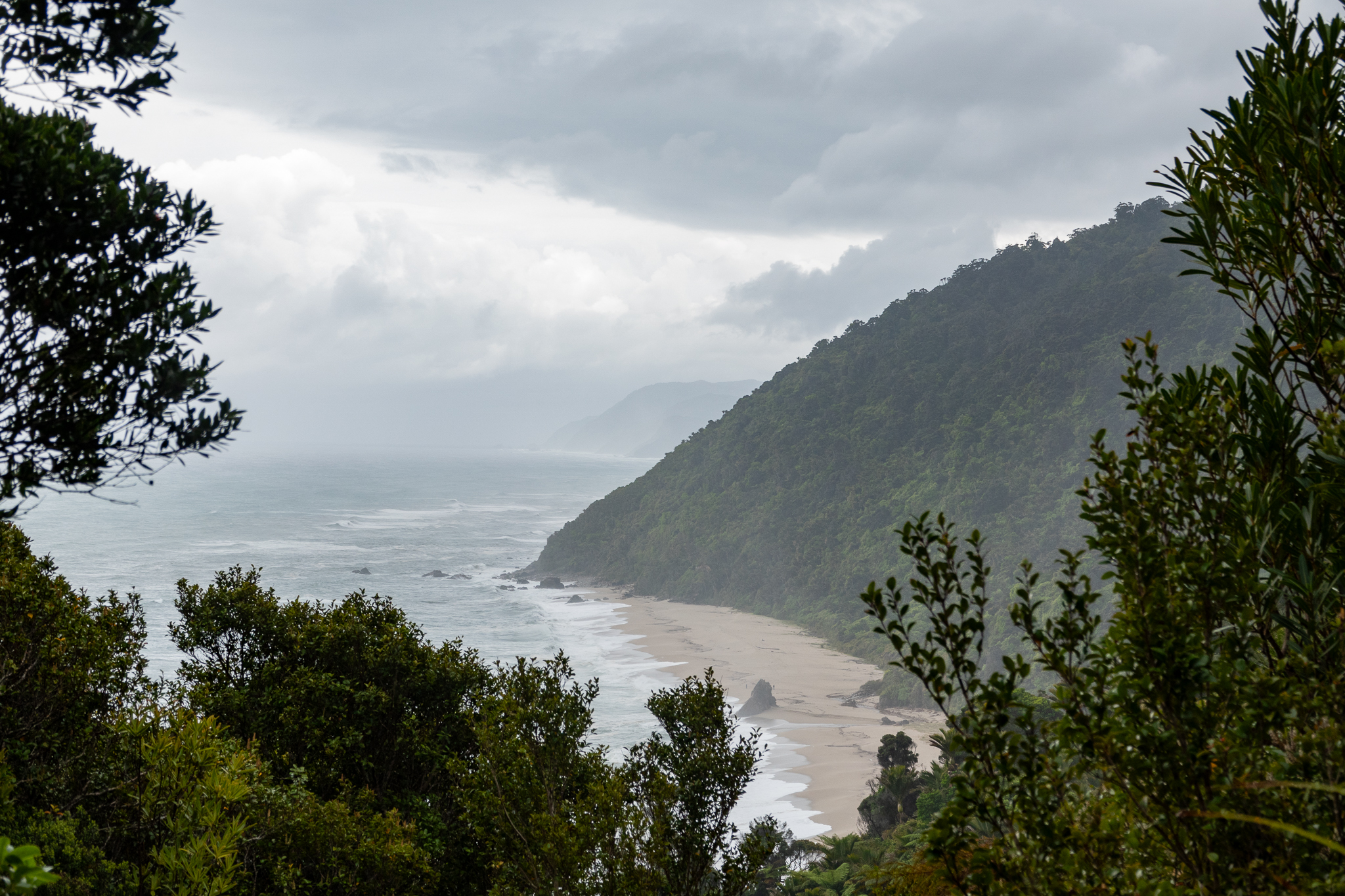
We were sad to leave Karamea, we really loved that it was so secluded and yet had all that you would need in such a small town. The weather was not great as we left and we had rain in the morning. By the time we got to Punakaiki, the weather was perfect. The tide was in and the beaches looked amazing with the white crested rollers slamming their way to the shore.
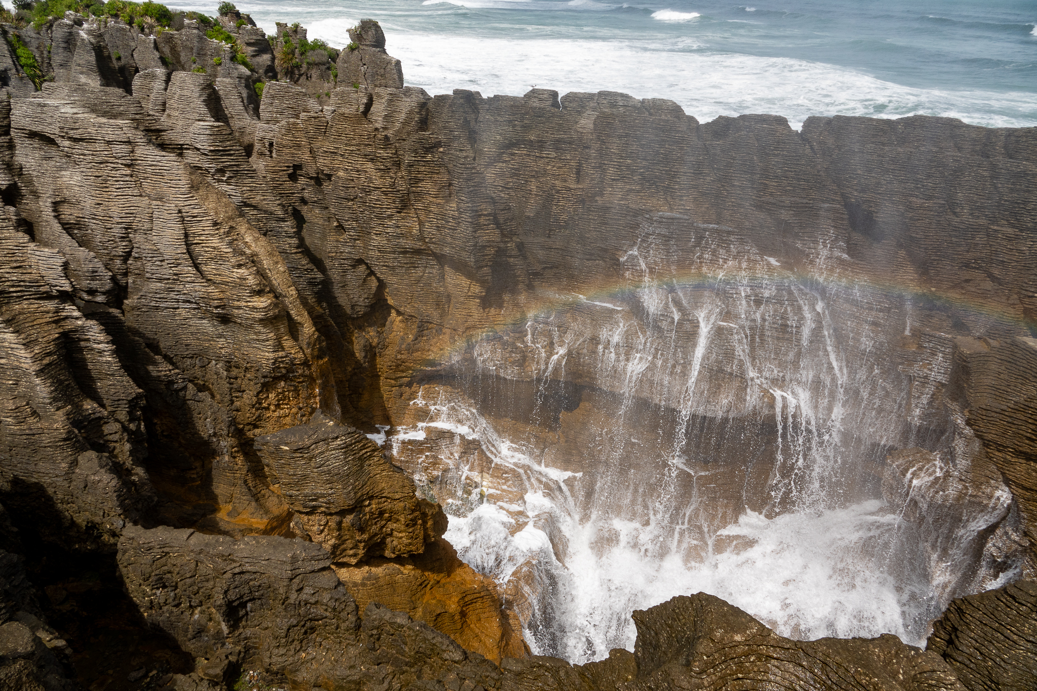
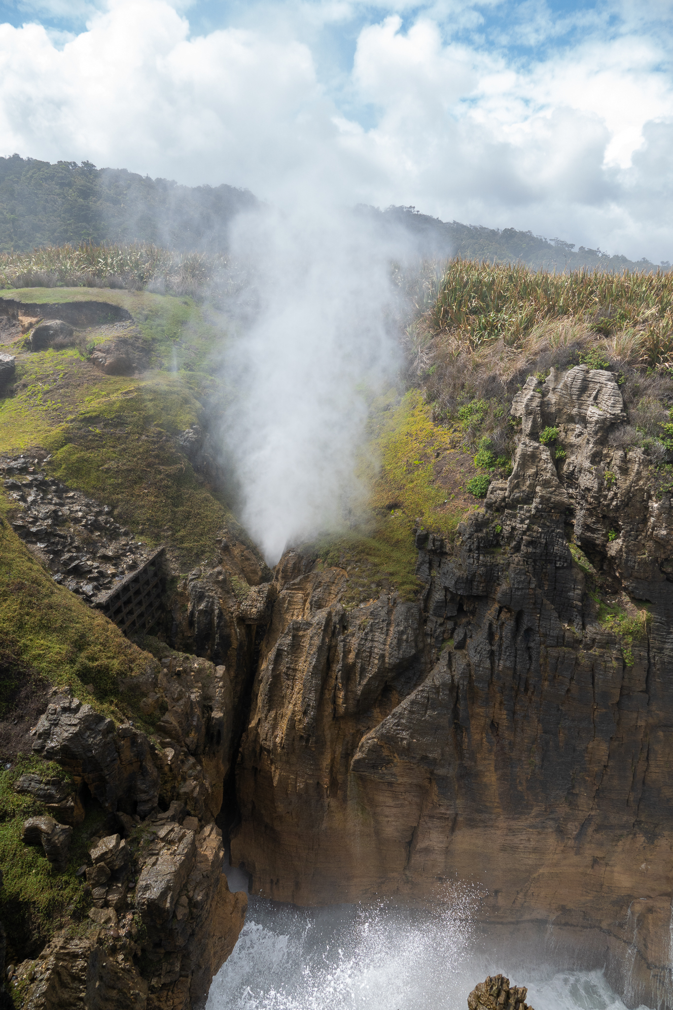
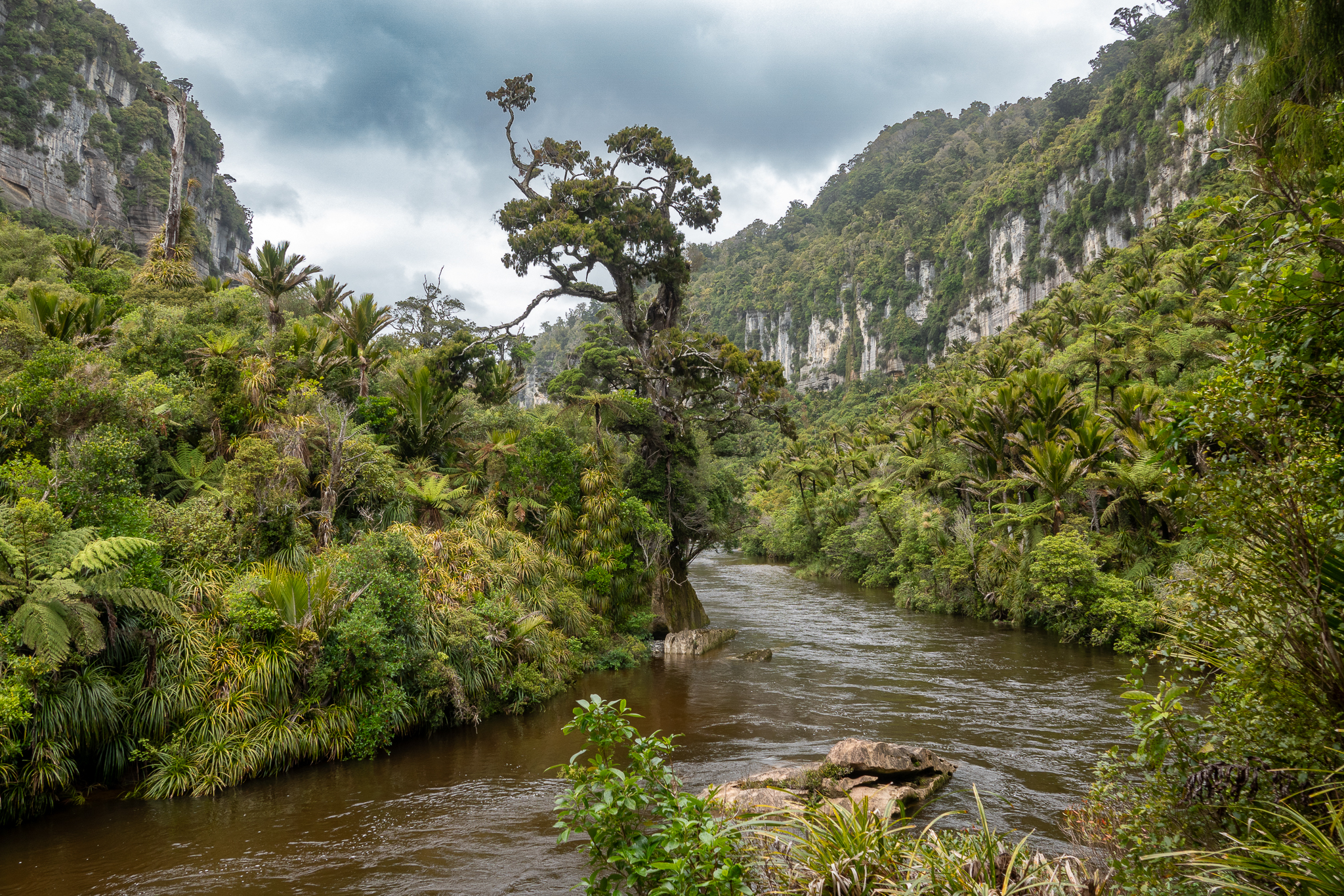
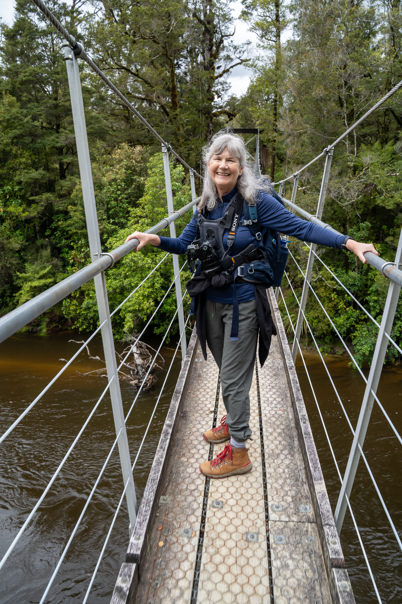
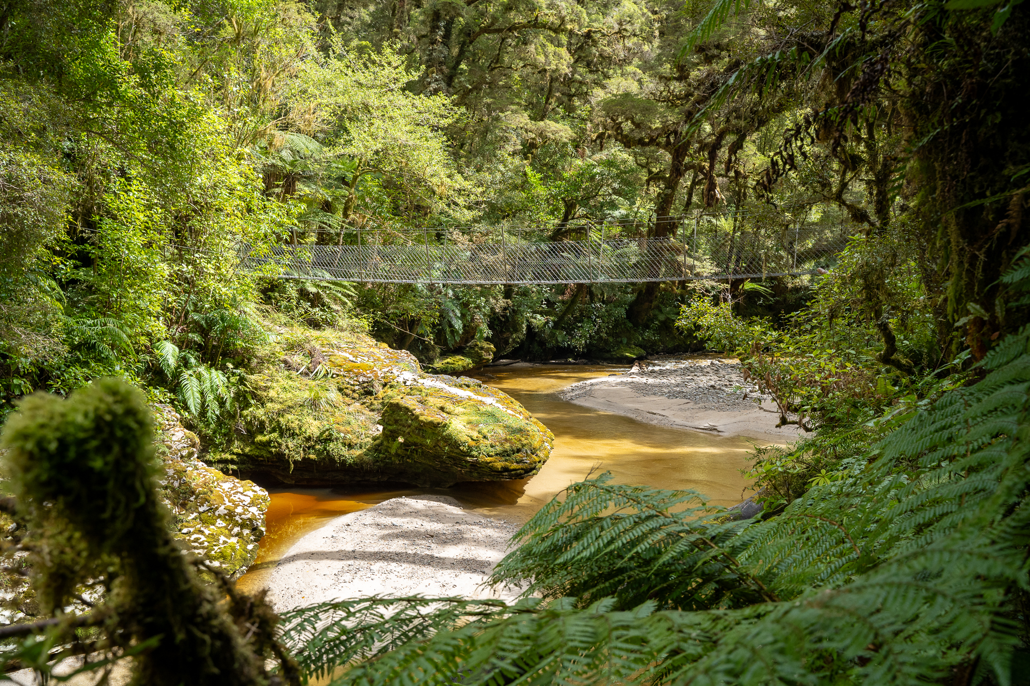
Punakaiki is known for the pancake rocks and blowholes and as the tide was high and the wind was in the right direction, they really did not disappoint. This is probably a good time to tell you that while almost all the pictures are mine, except from some really good ones from Rob, they are just a drop in the ocean of the numbers of pictures that we take at each location. Also we have been using the Insta 360 (you can google to see what that is) and so we have a boat load of video that Rob will edit when we get home. Don’t worry, we are not going to subject you to the extra photos and video. We also hiked up the Punakaiki river and gorge as far as the swing bridge that anfternoon and that was an interesting path.
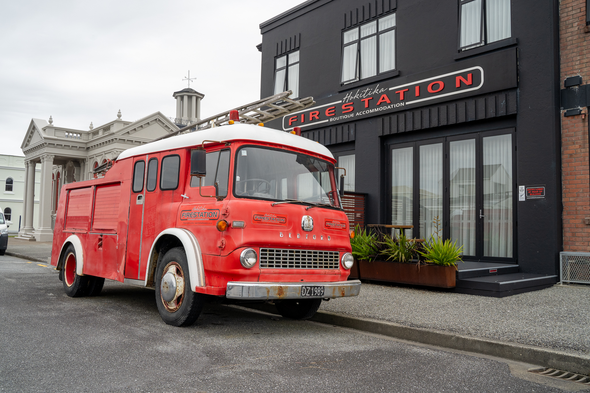
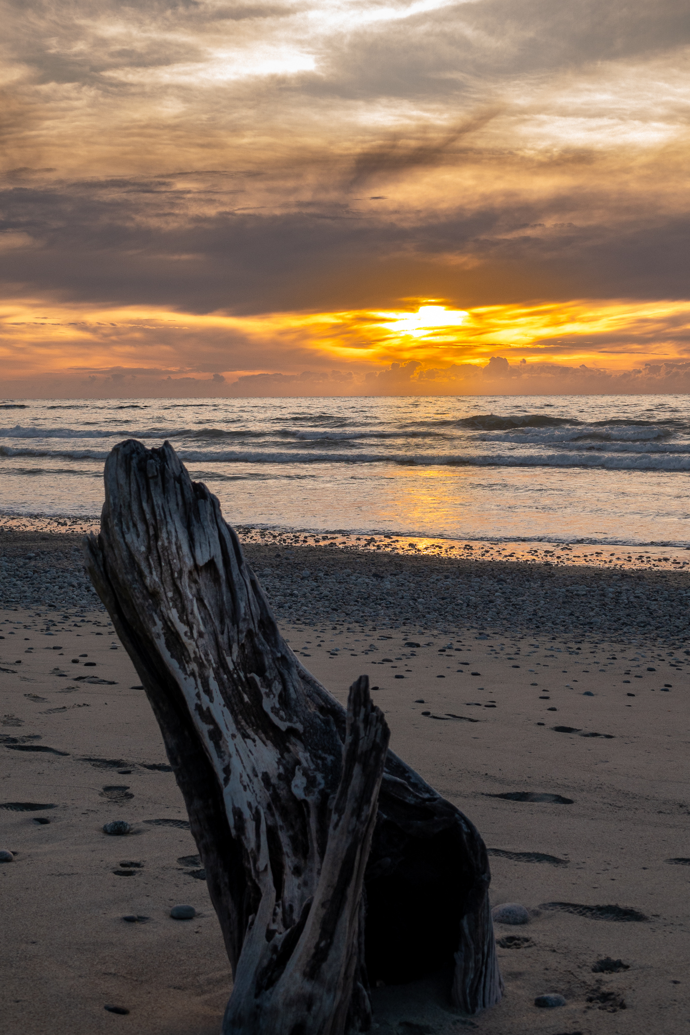
We drove on down to Hokitika and checked into our motel. Off into town for a lovely Thai dinner and then parked by the shore and waited for what turned out to be, a pretty lovely sunset.
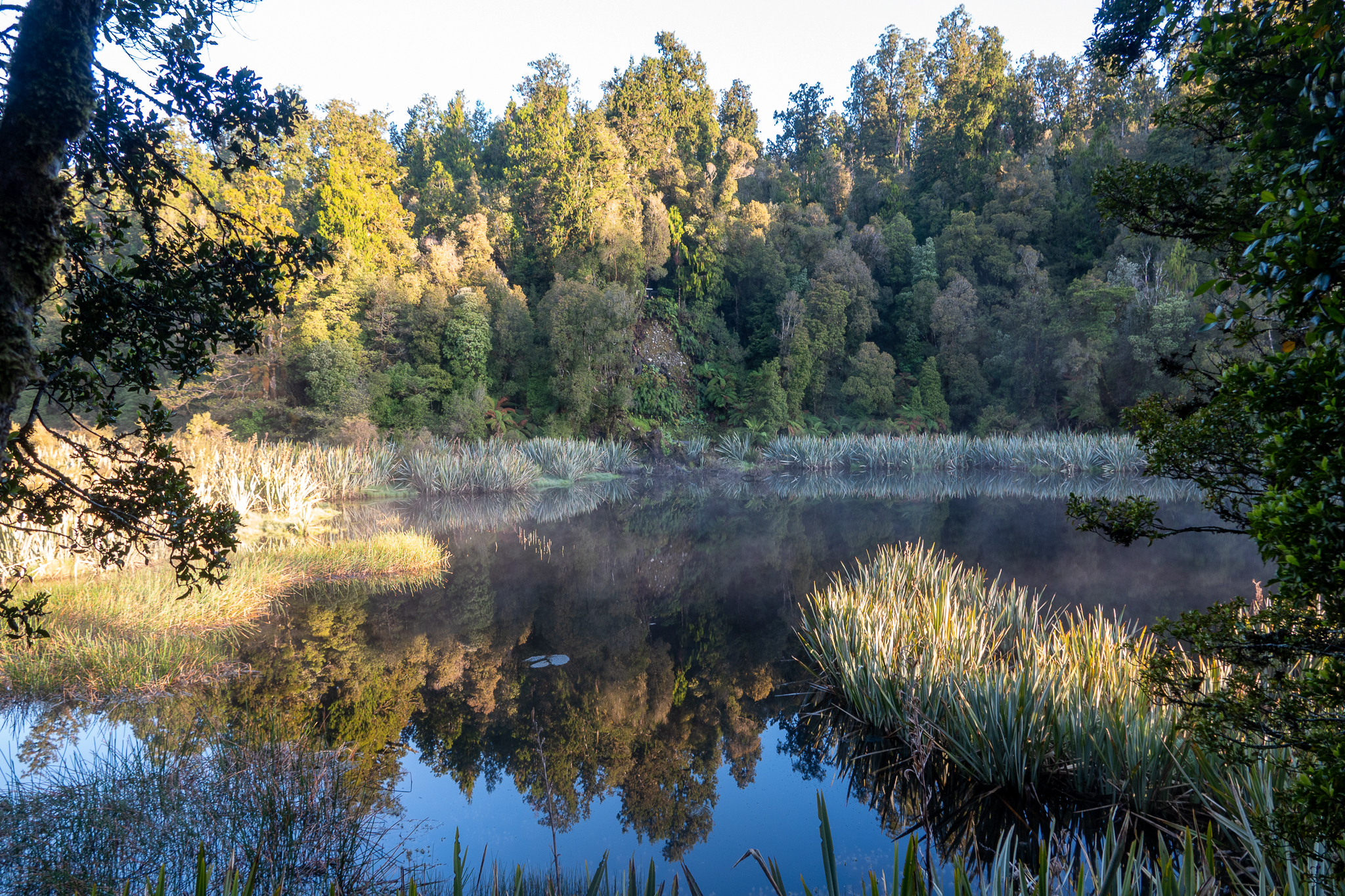
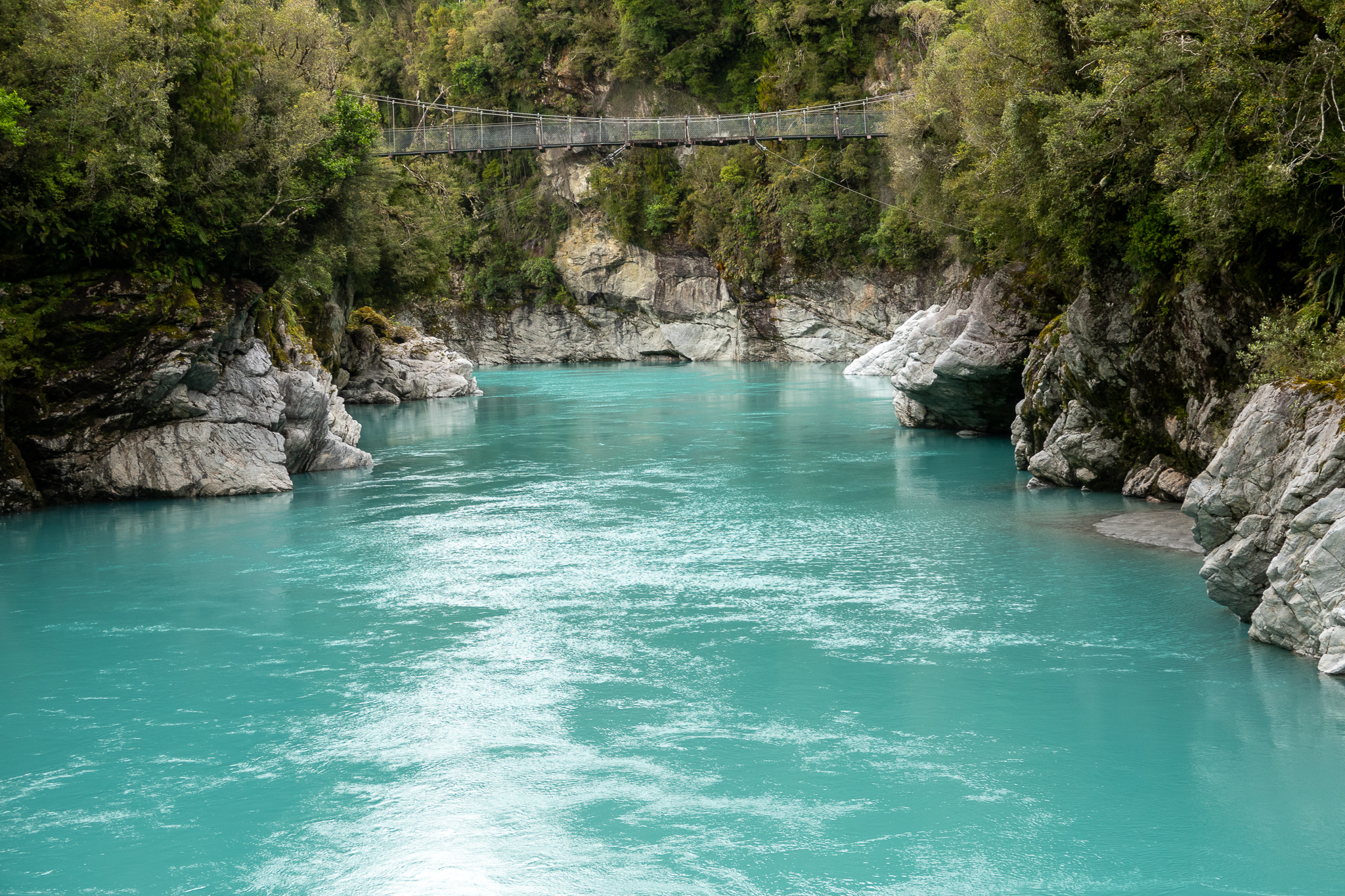
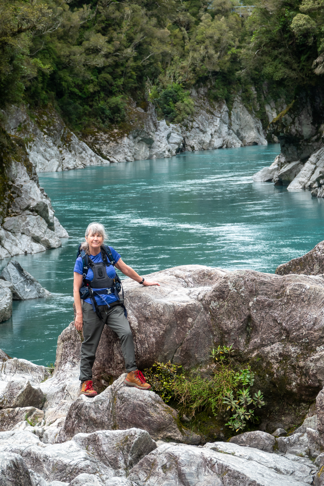
The next day we drove up to Lake Kaniere and hiked as far as we could before having to turn back as the path was very muddy and waterlogged and my leaping distance is not what it was. We drove up to Hokitika Gorge and were treated to the most amazing turquoise waters that ran through the gorge. According to the “Google” The water of Hokitika Gorge appears a mesmerising shade of turquoise blue due to the presence of glacial flour in the water. Glacial flour is a fine, silt-like sediment that is created by the grinding of rocks by glaciers. So now you are as informed as we were.
Into town again for a walk out to the point where Rob decided to reenact the scene from the Titanic, this would have been more impressive if you could have seen him trying to balance his camera at the right angle on the rocks, set the 10 second timer and then run like hell to get back onto the boat and in position.
That evening we had a really great meal at Stumpers in town, the Salmon was soft and moist and the vegetables were cooked to perfection. We shared a meringue and ice cream sundae (well I had a few spoons and Rob ate the rest) back to the hotel and left the next morning for our next location
We left Nelson bright and early. If you look at a map of South Island there are not many roads that go from east to west and so even though the distance as the crow flies would have been 58 miles, we actually had 198 to drive. As soon as we had arrived in New Zealand we purchased really good road maps of both Islands and that was useful as we lost both GPS and Cell signal on the journey. My poor cell phone had no idea where we were. The journey was very pleasant as we meandered through the valleys passing the many sheep, dairy and venison farms. Oh that reminds me, always make sure you have a full tank of Gas, there were no gas stations until we were right over on the west coast. The last leg of journey was “interesting” we had to go up and over a very high and winding mountain road, which went into one lane at places because the other half of the road had fallen into the valley with the severe weather last year.
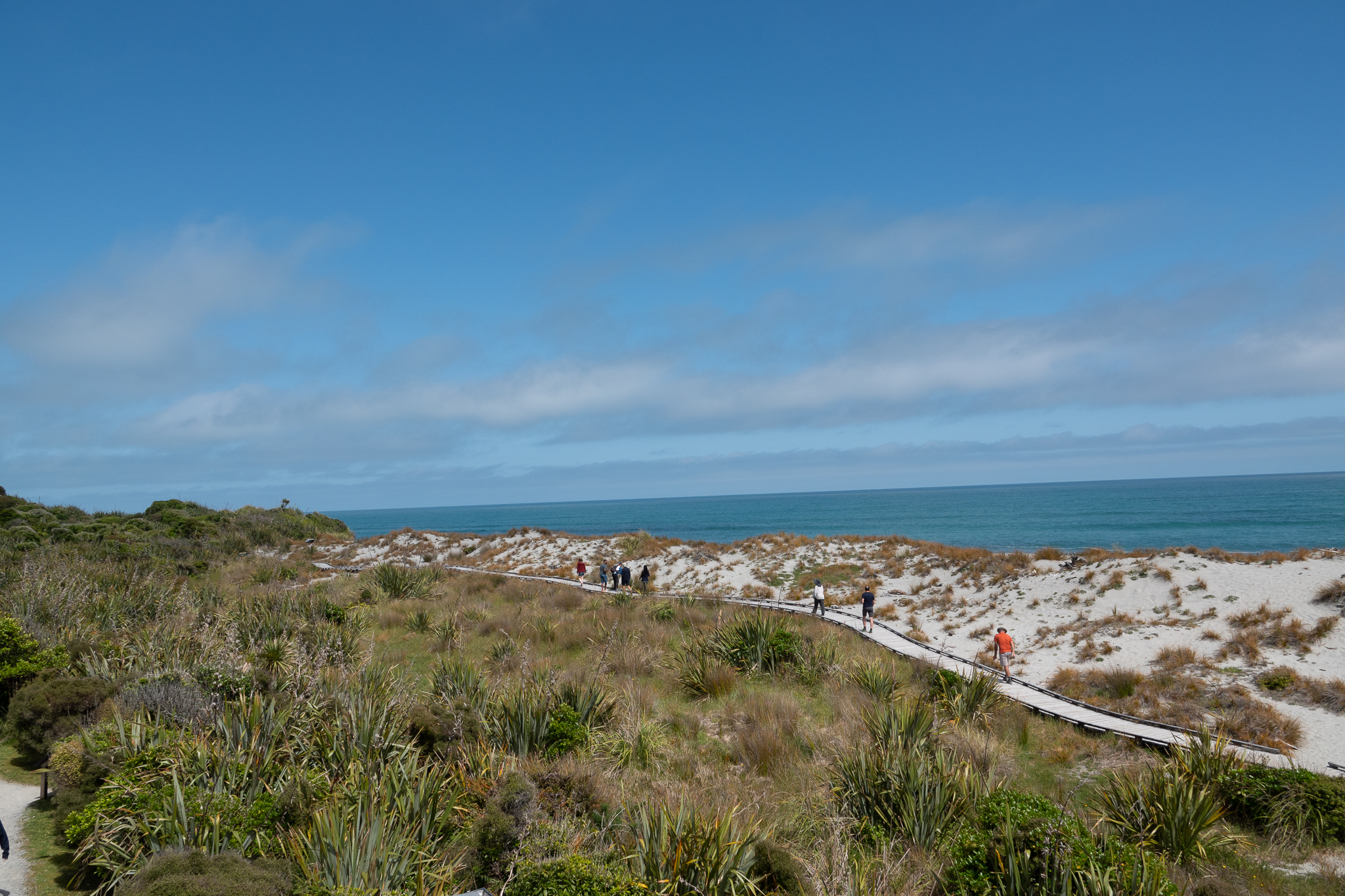
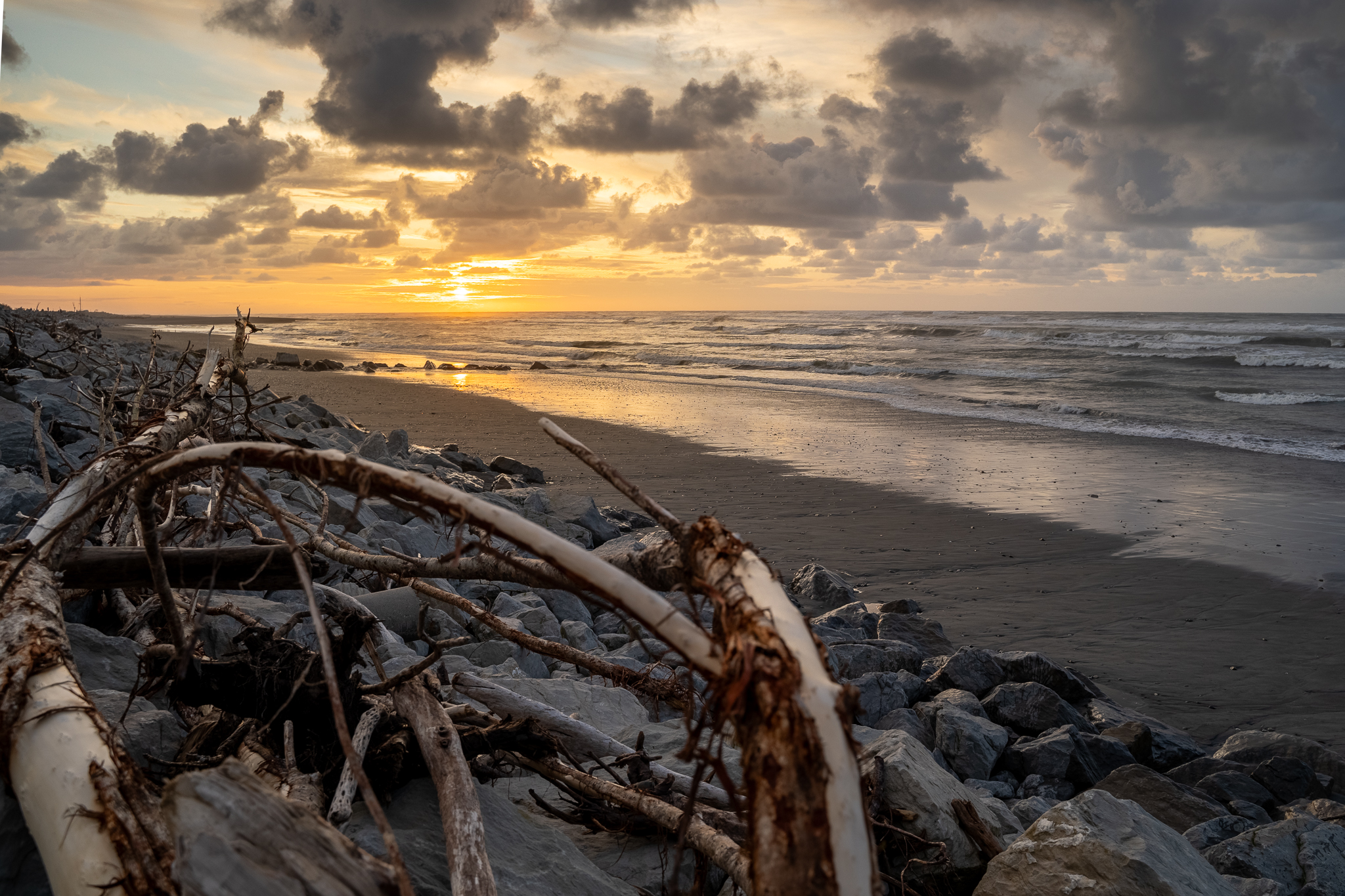
But we arrived safe and sound in Karamea, permanent population of around 400, the northern most settlement in South Island and only access in or out was the road we just arrived on. The Motel was delightful and a trip into the Town (well the streets where the few shops etc were) took us to the village tavern. I do have to admit that a friend of a friend that we had made contact with, and who moved back to Karamea some years ago had recommended both locations. But imagine our delight when we went in and there was a roast dinner on the menu with roast and steamed vegetables! Hurrah, I was beginning to think we would arrive back with scurvy given the lack of vegetables we had been eating. After dinner we took a walk to the beach and while not the best sunset, it was still pretty good.
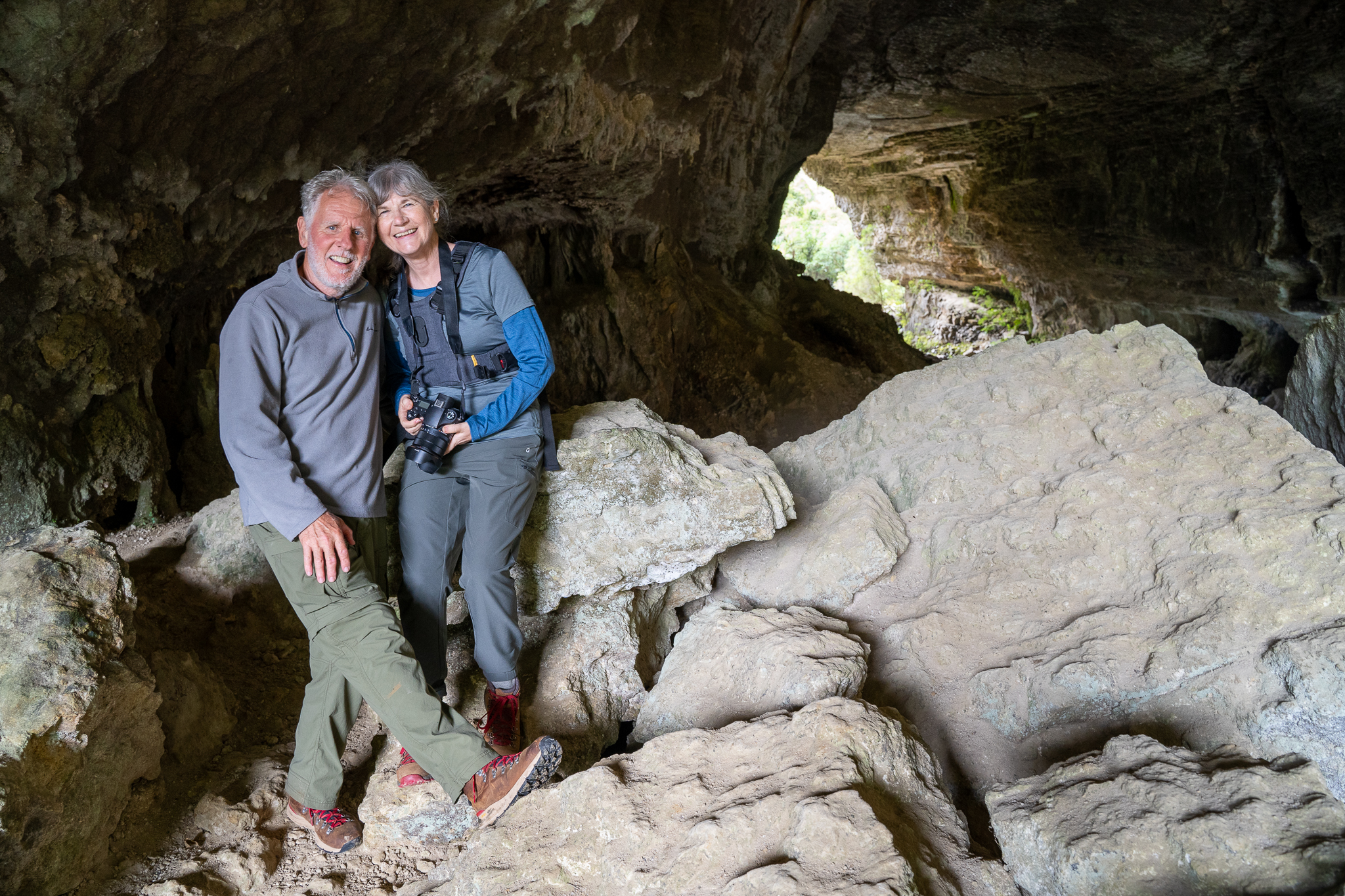
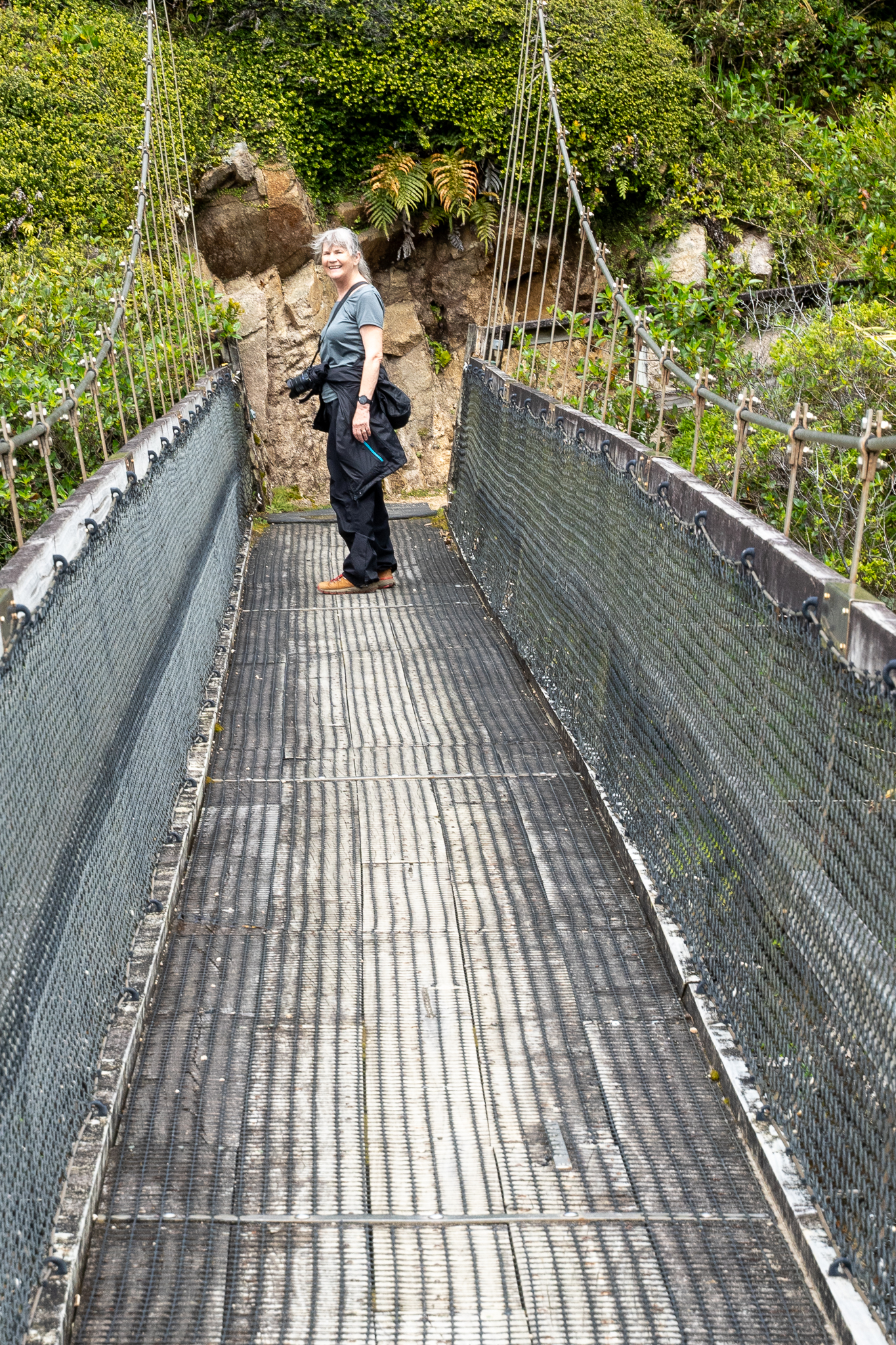
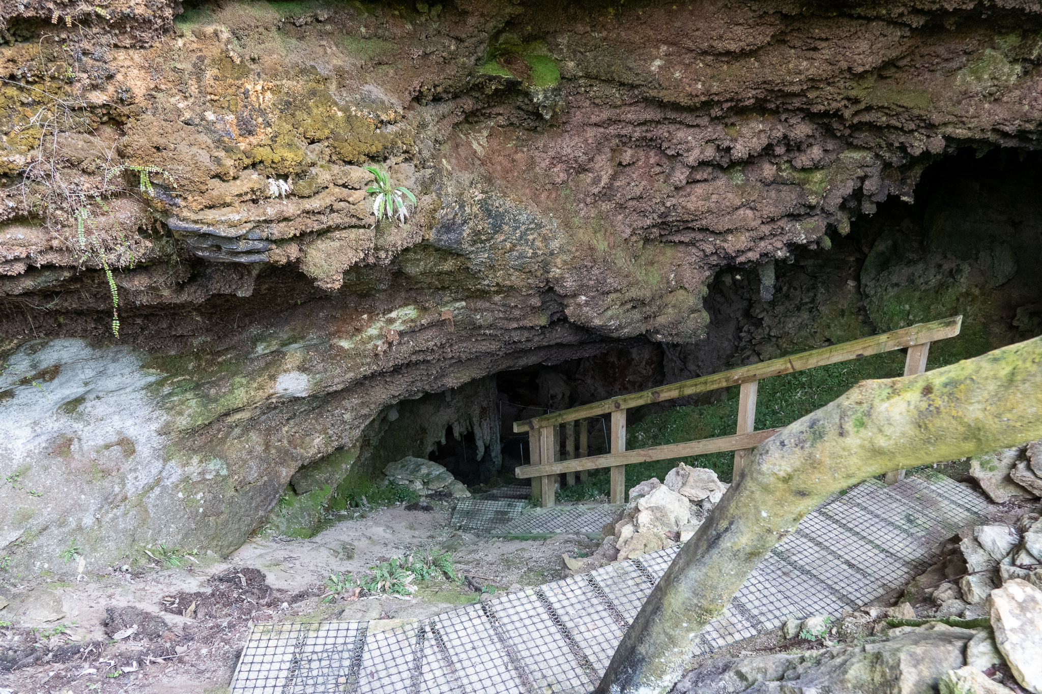
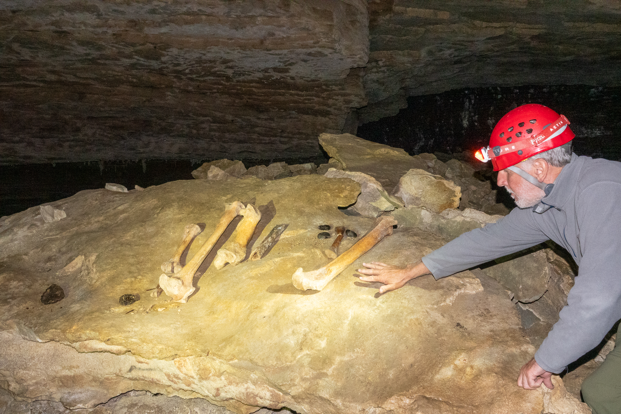
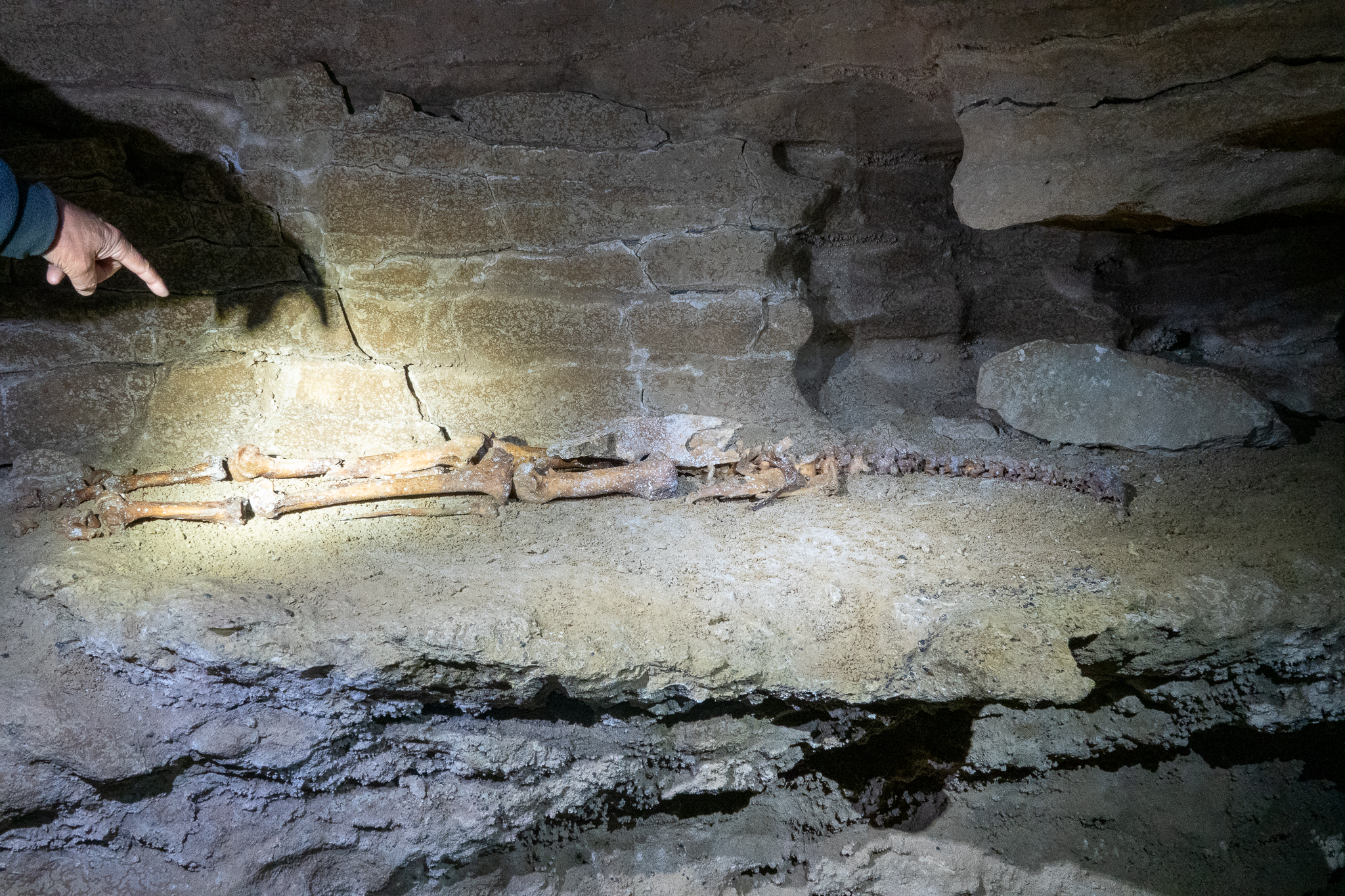
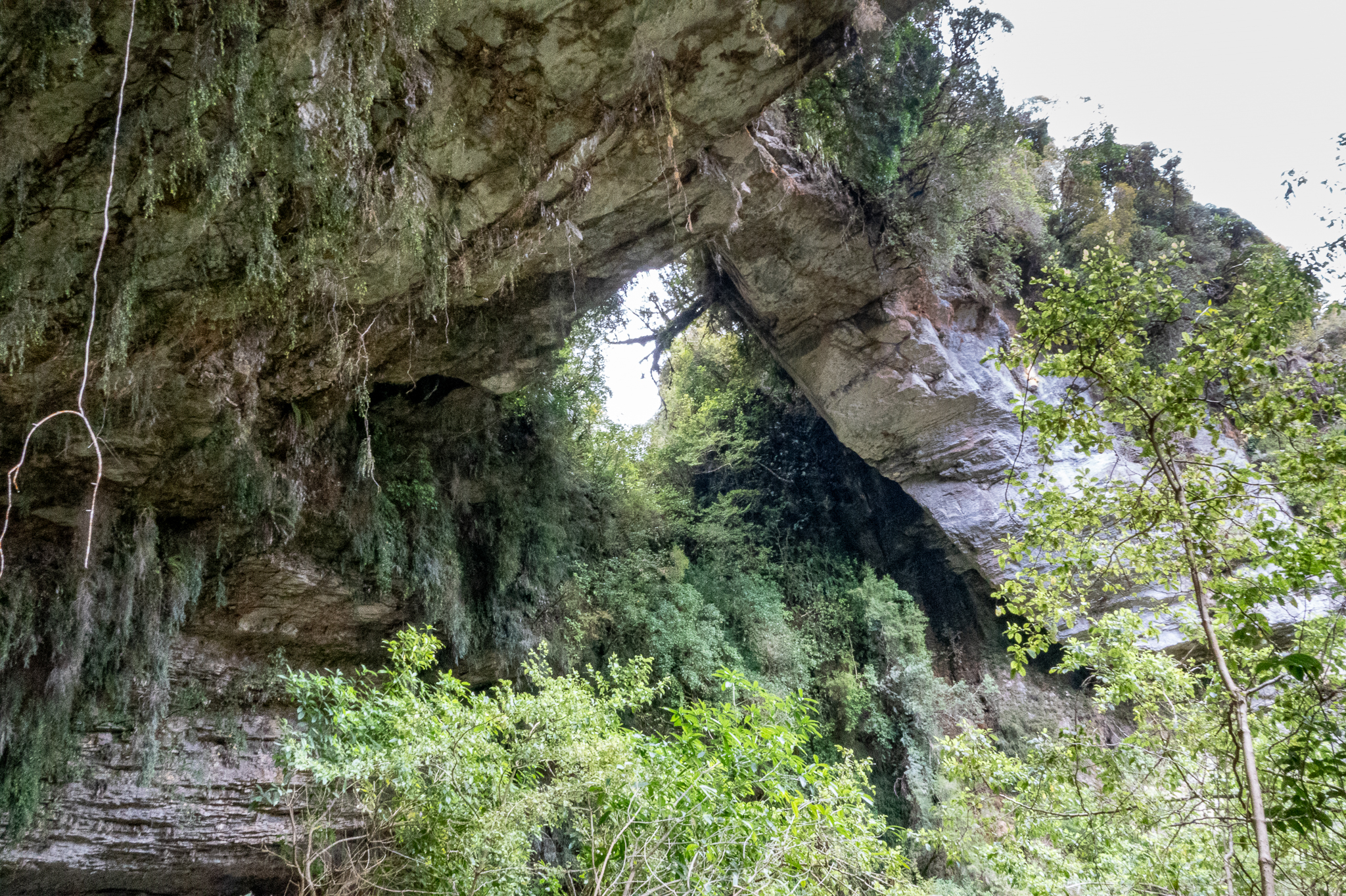
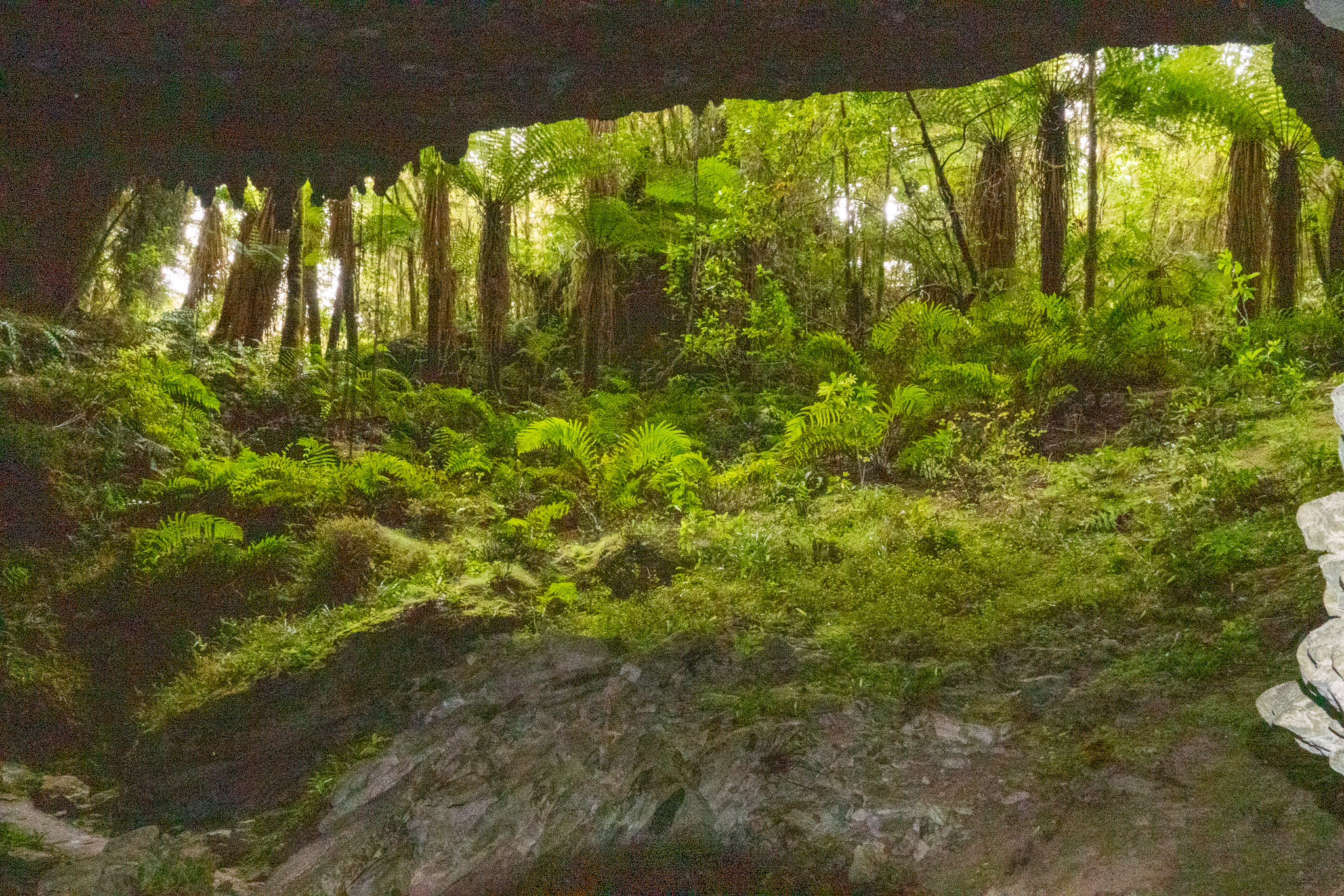
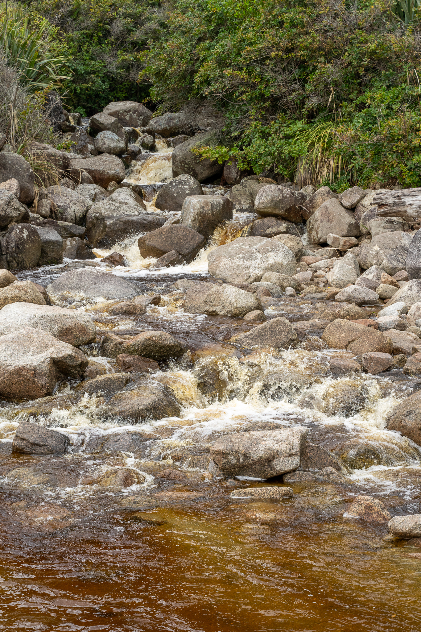
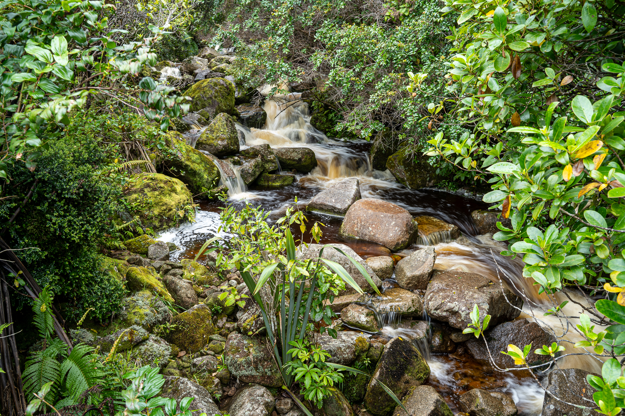
The next morning we were picked up at the motel for a guided tour of the Oparara Arches and Honeycomb Hill caves. You are only allowed in with a guide and there was just the two of us, so we had a great day. The guide was called Rob and he and my Rob shared all the same interests and hobbies, it was almost if he was a brother from another mother. We started off to a walk to the caves and found out some fascinating facts about the local flora and fauna. Also when the caves were discovered in the 80’s there were complete intact skeletons for Moa, a huge emu like bird that was now extinct, that must have fallen down one of the holes in the forest floor and perished. They also found an extinct Haast eagle skeleton that was later moved to the Te Papa museum. We also got to see Glow Worms in the caves that was a very interesting sight. Back to the car park for lunch, this was provided as part of the trip. We kept a careful eye on our food as the local Weka were on the prowl. After lunch we strolled to the famous arch and then made our way back to the car. During the day, while we were talking to Rob (other Rob) he was astonished that we would consider leaving the town without walking part of the Heaphy Track. And so we arranged to stay an extra night in town. It was interesting to note that the brown color in the otherwise clear waters are from the natural tannin leeched from the trees
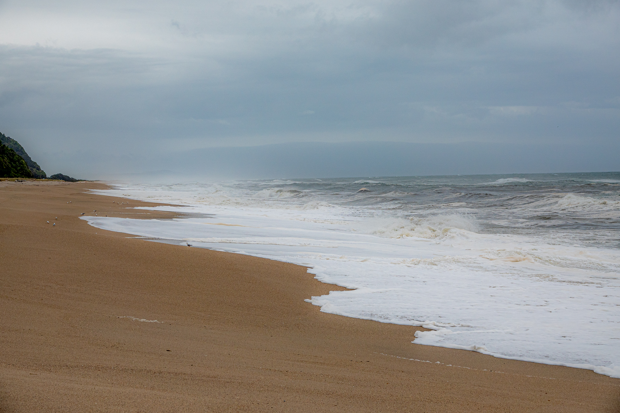
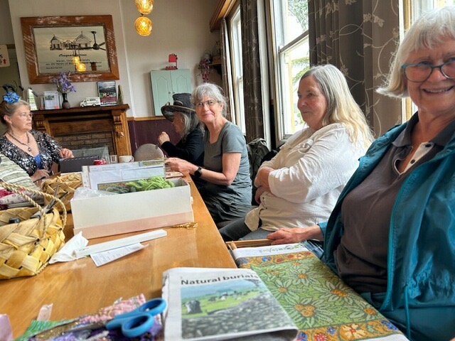
Next morning we met Anji for coffee (the friend of friend) and had a lovely hour talking about the area and life in general. Just as we were about to leave for out walk, she mentioned that she had her local crafting meet up at the tavern that afternoon. So off we went for the walk, one of us was upping to pace so that we could get over to Scotts beach, which was just beautiful and back into town for the afternoon so that I could join the ladies and stitch a while. It’s been a great experience here and still lots more we could have explored.